Page 2 of 14
Posted: Thu Jan 22, 2009 1:49 pm
by HeadDamage
A bit more reading on the subject:
http://www.sonic.net/~ckelly/Seekay/canol.htm
The last thing we expected as we sat eating lunch was the sound of a motor, but it was unmistakable. Presently a tiny motorcycle hove in sight, piled high with camping gear, a folded inflatable raft, a rifle, camera gear, and almost incidentally a rider. His name was Archie Knill, and he had started out from Norman Wells on his trail bike the summer before. He told a harrowing tale of capsizing his raft while crossing a river, nearly losing his camera gear and motorcycle, then dismantling and drying his engine.
Caught by snow (in August) before he could complete his trek, he had left his equipment at a hunting camp and flown out the previous summer, returning almost a year later to retrieve it. He also told us of the river crossings we would have to deal with soon. "I had to cross the Ekwi river six times," he reassured us, "But you can carry your bikes, so the only bad one should be the last one, where it's deep. Pretty wide, too." He regaled us with bear-escape stories before leaving.
Posted: Thu Jan 22, 2009 2:09 pm
by DaveB
We have to drive out the we we came...
Well, when first discussing this trek my thoughts were to go as far as we could, certainly further than the motorcycles, but at some point make a reasonable decision to say "enough" and at that point turn around.
However as a group not all of us are on the same page yet as to what's enough. Reading a book on the subject recently, it reflects much the same info as your last link — that its become nothing more than a gravel path and is no longer a road. But I know how hikers think, and we constantly surprise them as to where we've gotten — staying on the road — when they think its no longer passable for motorized vehicles.
I like those kinds of challenges, but we as a group have to decide how much of a challenge we are prepared to do before we say enough. My initial plan was to go as far as we could, then turn around and go to some other Yukon destinations and tour around.
Others are in for more of a hardcore adventure. Its up to us over the next several months to educate ourselves and decide where the right place to draw the line is. Anyone got a float plane that we can use to explore?
Dave
Posted: Thu Jan 22, 2009 2:48 pm
by red90
Dave wrote:However as a group not all of us are on the same page yet as to what's enough.
:lol: Don't you just love those parts of the trip.
Posted: Thu Jan 22, 2009 3:27 pm
by red90
I had a look and the "ibycus" maps show the first 100 km continuous and quite a bit of the rest of it in pieces, but it looks pretty good.
When I am bored, I might throw it all together into a track file for other to look at via whatever method they like.
It looks like quite an involved route....
Posted: Thu Jan 22, 2009 6:12 pm
by HeadDamage
I'm thinking that we would need a fair amount of pioneering gear and man power. Likely should have at least two able bodies per truck... trees look to be a bit small, might need bridging equipment of some sort and ground anchors.
A couple of small trail bikes to scout ahead might be nice to.
Posted: Thu Jan 22, 2009 6:27 pm
by DaveB
OK, so you're onside to go all the way through now, Andrew? I agree with your assessment of needed equipment. I think it likely goes beyond that too...
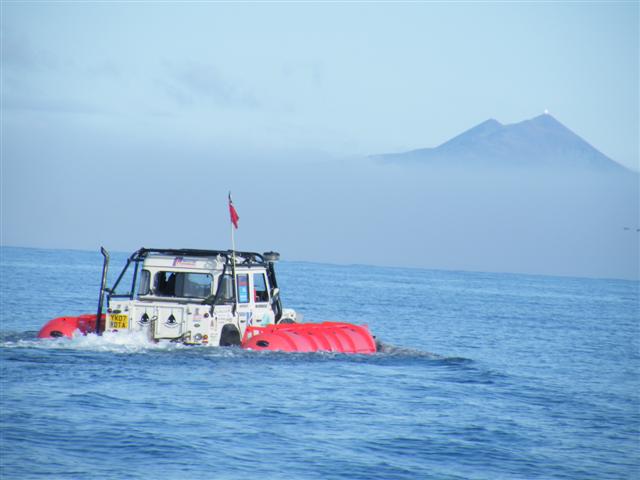
Check out the photo galleries from Founders Day and you'll see Mark M has built a crane for his truck. This just leads to the next big project... pontoon inflatable rafts interchangable between all the trucks. Like the ones used on the recent Cape to Cape adventure:
http://www.capetocape.org.uk/images/Mar ... Small).JPG
But the difference with ours is it will have to be set up to easily attach to every vehicle, whether 88", 90" 100" or 110". Peter T. and I get to go on long road trips together from time to time so we've had some long daydreams about how to do it. We're thinking a subframe attached to the sides of the truck to accept a 2" trailer type Class III receiver and pin the pontoons on as required, then winch them back across the water for the next vehicle.
Lots of ideas... something to pass the time while its chilly out!
cheers, Dave
Posted: Thu Jan 22, 2009 6:34 pm
by Doc Tari
I spoke with the tourism and parks manager today and confirmed that the Canol Trail is still open to motorized transportation. He said that they're working to make it a restricted trail and if that happens, it will be closed to vehicles. He's not sure when that will happen but I guess that if we want to do it, the sooner we go, the better.
I also asked him about the depth of the more severe fordings in August or September and he said it really depends on how much snow they received the winter before, how wet the summer was, luck, etc. (naturally) but it could be anywhere from a couple feet to well over your head. Most of what I've read and from pictures I've seen, thigh to waist deep seems to be most common. How far do we go in preparing for deep water (pontoons, bridging, etc)?
Finally, I checked into routes out of Norman Wells and as Andrew's already stated, unless we do this in the winter, it's back out the way we came or via barge. Did a quick check on barge rates it looks to be expensive: $800 - $1000 for a single vehicle but we may be able to get a charter and save $. I'll make a few calls tomorrow but back-tracking looks to be the deal.
Posted: Thu Jan 22, 2009 6:40 pm
by DaveB
Hi Pete,
We may only need a barge to Wrigley as there appear (at least by Google Earth) to be a fair network of roads south of there, especially if we have our own pontoons for crossing rivers.
You're making me want to abandon all care and say I'm going, but I just don't know if it'll work this year for us. I guess I'll continue intending to go as I just can't resist this chat we have going.
Dave
Posted: Thu Jan 22, 2009 7:01 pm
by DaveB
Pontoon designs... Well maybe if we have the Max boys welding it, we could build solid pontoons that would act as screw drives...
http://www.icechallenger.com/icechallenger/ice-adsl.htm
OK, maybe we don't quite need this big of pontoons... but they're pretty cool for all types of terrain!
Dave
Pontoons
Posted: Thu Jan 22, 2009 7:31 pm
by chilliwack
Just a though, following the thread
What about talking to the X-Jack people about sponsoring the pontoons?
Cheers,
Roger
Posted: Thu Jan 22, 2009 7:33 pm
by HeadDamage
Pontoons are good for lakes and such but a bit more hairy for moving water. We would likely need to rig a cable ferry type affair that uses the current to move the load across but does not drag it under or flip... I think we will need to do some thinking on this.
We need to determine exactly how serious the water crossings are and also what sort of terrestrial obstacles need to be crossed. Severe side slopes, gullies, bolder fields, etc...
This needs to be a well organized team effort to push a limited number of rigs through. Should make a good TV show... hint, pay for the barge idea :idea:
I'm not sure if I would take my best truck or a truck I could afford to leave on the trail... it depends on how organized we are. I'm thinking practice and prep this year and try it in 2010 or 2011 depending on how much we figure it will take to do it.
I'm very interested but also very interested in still having a truck at the end of it ;)
Posted: Thu Jan 22, 2009 7:46 pm
by DaveB
What about if we looked at the Spatsizi/Skeena route this year, which has several water crossings that are a bit lesser than the Canol from what I can tell — but may still require pontoons, and aim for 2010 for the Canol Trail?
I think there's a much higher possibility of getting through this route, and also with our existing club connections chartering a bush plane to reccy the route out in advance.
Here's the previous thread I posted on the topic:
http://www.roverlanders.bc.ca/roverforu ... php?t=1186
It shows the basic route in Google Earth.
Dave
Posted: Fri Jan 23, 2009 12:42 pm
by red90
I quickly stitched the "Ibycus" data together last night. It actually covers well over 90% of the trail.
I show 365 km from the border to the Mackenzie.
Posted: Fri Jan 23, 2009 3:10 pm
by HeadDamage
Posted: Fri Jan 23, 2009 7:12 pm
by red90
OK, here is the track I made up with waypoints of the major rivers and such. Mainly based on the Ibycus Topo maps which gets its data from teh Feds.
http://members.shaw.ca/red90/Canol_Road.gpx
You should be able to open that into most map programs, including Google Earth. The best useful view is in Mapsource with the Ibycus Topos.
Canol road Tracking
Posted: Fri Jan 23, 2009 7:31 pm
by ANDYD
Hi Red90,
Looks like you did a great job with tracking the waypoints along the trail, but you will have to help us less-computor-savy a little more and explain how we put this list of numbers into Google Earth...
thanks in advance,
Andy
Water crossings ...
Posted: Fri Jan 23, 2009 7:44 pm
by ANDYD
This is a great thread, cant help but get drawn to the challenge of it all!
Obviously the river water crossings will be the greatest obstacles, I was reading in some places that the trail and river have become one, with steep slopes on both side the only option will be to drive down the river in some spots.
With a snorkel, we should be able to "wade" up to waist deep, keeping a rope or winch cable to another truck on the bank should give some feeling of security. We should try and walk the crossings as much as possible (bring a pair of waders).
One would hope that none of the crossings would be deeper than waist deep in late August?
ummmmmm
Posted: Fri Jan 23, 2009 8:03 pm
by Doc Tari
Andy,
By saying we, does this mean you're up for the challenge? If so, glad to hear it! After all, you are our president and should lead by example. That means you go into the water first (and I don't mean on foot)... :D
Re: Canol road Tracking
Posted: Fri Jan 23, 2009 8:23 pm
by Dave_F
ANDYD wrote:Hi Red90,
Looks like you did a great job with tracking the waypoints along the trail, but you will have to help us less-computor-savy a little more and explain how we put this list of numbers into Google Earth...
thanks in advance,
Andy
Andy...Click on the Canol_Road.gpx link in the Roverlander message and right click. THis will give u a pop up menu and you will select
save link as...
The next menu will be the save menu and you'll note that the file name Canol_Road.gpx will be saved (put in on your desktop for easy access) as a text doc. Go ahead and
save.
Now open Google earth and select
open from the main menu. You will need to change under
files of type at the very bottom and change it to
GPS (*.gpx*.loc), then you should be able to see the file that you have saved to your desktop...click open on that and presto...trail marked on google earth.
Cheers,
Dave
Posted: Fri Jan 23, 2009 10:13 pm
by red90
Thanks Dave.
There are some ways to get the Canadian Topos to work on GE as well. See
http://ge.gbif.net/gbifwmslinks.php It is a little slow and not as clean as with Mapsource, but it works. You can see that the track I am showing is from the Federal topo maps.
And, yes, the road goes down some very narrow canyons.....
Posted: Sat Jan 24, 2009 12:47 am
by Dave_F
Now that is very cool...Gives a much more detailed view Topographically speaking. Shows swamps, rivers and creeks and even some alternate road? routes.
Slow but worth the wait...this really helps give an idea of what kind of terrain we'd be running.
Good Stuff!!!!
:D
Thanks ..
Posted: Sat Jan 24, 2009 9:23 am
by ANDYD
Thanks Dave for instructions ... :D
Now lets see if I can figure it out !
Cheers,
Andy
Posted: Sat Jan 24, 2009 11:53 pm
by Doc Tari
Though it's still months away, we should probably start getting an idea of who expects to join the Canol Heritage Trail expedition. I say expedition because this is going to be long 6000km (?) round trip, time consuming (~3 weeks?), and likely rough (washouts and deep water crossings). The timing is expected to be late summer, since that's when the rivers are lowest.
Google Canol Road or Trail to learn about its history and location and post up if you'd like in. I'll begin a list on the first post of this thread.
Posted: Sun Jan 25, 2009 8:53 am
by John
For those interested another good read is "A Walk on the Canol Road" by S.R. Gage. A single copy is available in the Fraser Valley Regional Library system with the book currently residing in Langley.
Posted: Sun Jan 25, 2009 5:38 pm
by JD