Page 1 of 1
Canol Road 2009
Posted: Mon Jan 19, 2009 8:58 pm
by Doc Tari
Though it's still months away, we should probably start getting an idea of who expects to join the Canol Heritage Trail expedition. I say expedition because this is going to be long 6000km (?) round trip, time consuming (~3 weeks?), and likely rough (washouts and deep water crossings). The timing is expected to be last two weeks of August and the first week of September.
Participant ................... Vehicle
Pete L. ................... D110/300Tdi
Kris M. .................... D110/300Tdi
Dave F. ...................... S109/2.25
Norman .................... D90/200Tdi
Shawn D. ................... S109/2.25
Charlie .................... Unicat U500
Min. required
2 - Chain saw ....................... Kris, Dave F.
2 - Axe .................................. Kris, Dave F., Norman
2 - Ground anchor................. Pete, TBD
1 - Satellite phone ................ Pete
1 - SPOT transmitter ............. Norman
2 - Video camera .................. Pete, Dave F.
3 - Air compressor ................ Kris, Pete, TBD
1 - Welder ............................ Pete
1 - Boat ................................ Mark, TBD
8 - Large ratchet straps ....... Kris, Norman
20 - Small ratchet straps ...... Pete, Norman, TBD
3 - FRS, walkie-talkie, etc ..... Dave F.
2 - Sankey trailer .................. Kris, Mark, Dixon
2 - Traction/bridging plates .. Pete
4 - Winch .............................. Pete, Kris, Mark, Dave F., Shawn
Extension winch cable .......... Pete, Kris, Mark, Norman
http://i647.photobucket.com/albums/uu19 ... _21_43.jpg
At a previous Rover-Landers monthly meeting, there was talk of a trip over the Canol Road. Since I wasn't able to make this month's meeting where this year's event planning was to take place, I was wondering if the Canol was discussed. Has the timing been established? Route? Plan for crossing the deeeeep water....? :shock: Any info for those of us that need to plan in advance for the time off is appreciated.
Thanks,
Pete
Canol
Posted: Mon Jan 19, 2009 10:11 pm
by Dave_F
Hi Pete,
Is the Canol Road you are referring to the one in the Yukon? How far up would you go and when? My son and I are planning to drive up to Whitehorse this summer and I have been eyeing this road as a possible circle route. Up to Carmacks then east to Faro on #4, then onto Ross River and back down Canol Road #6, to Johnson's crossing.
Don't know much about the route other than it is very remote, virtually no services, but looks "freakin" incredible as far as scenery and wilderness.
You ever been up there?
Cheers,
Dave_F
Posted: Mon Jan 19, 2009 10:23 pm
by DaveB
Hi Pete,
I had pencilled in the first 3 weeks of August as a tentative date for the Canol Trail — road being south of Ross River and Trail being north and into the NWT.
Unfortunately Pamela and I are pretty sure this is not our year for that trip. I'd love to go, but you guys will have to go first and build all the bridges for us! :wink:
Dave F, yes it is one and the same, and gets more rugged the further northeast you progress, until it finally disappears somewhere around 80 km into NWT.
cheers, Dave
Posted: Mon Jan 19, 2009 10:38 pm
by Doc Tari
DAVE B., YOUR NOT GOING? I thought you were in charge? Uh, anybody got a map...? :wink:
Bridges? I was thinking more like a raft or pontoons. Hardcore! Come to think of it, a nav chart may be more useful than a map. Maybe a Mog? (see picture to the left...)
Dave F., I've been through the area but never on the Canol Road. From what I've read, the road is decent until you reach the NWT border, then it becomes a trail and the fun starts. It's not really seen any use in many years and there are several water crossings, some of which may be kinda deep...
Event planning 2009
Posted: Tue Jan 20, 2009 12:03 am
by ANDYD
Hi Pete,
We did table the 2009 Event planning at the last meeting but, alas, we ran out of time (actually we were asked to vacate the room! :shock: )
So we will revisit the event planning at the next meeting.
Sounds like a great trip, the kicker for me is it will probably require 2 to 3 weeks for that kind of distance. What do you estimate for time line?
cheers,
Andy
Posted: Tue Jan 20, 2009 12:57 am
by Dave_F
I figure 3 weeks for our trip...I'm in a Series :lol: I'm thinking of either going up the Stewart Cassiar for a little more scenery, so that adds a day to the junction up, but I think it would a much more interesting run up to the Yukon.
Pete... I've Google Earthed the route I was thinking of going on and didn't see any water crossings? Are they on Canola north of Ross River?
Posted: Tue Jan 20, 2009 10:18 pm
by Doc Tari
Hi Dave,
I was thinking we would try to go from Johnson's Crossing east on Canol Road (#6) and beyond. Over Macmillan Pass and on to Norman Wells. Maybe this link will help:
http://canoltrail.tripod.com/ Click on "Trail Info & Map" near the top.
There are several water crossings, one or two may be too deep to walk across or ford. This is where the pontoons come in. Oh, and did I mention the boulders... 8)
Pete
Posted: Tue Jan 20, 2009 10:30 pm
by Dave_F
Hi Pete,
Looks pretty rugged...do you know if you can actually drive all the way to Norman Wells...reading the notes, it seems that it keeps referring to the trail? I think just this section (if drivable) would take 3 weeks...lol
Cheers
Posted: Tue Jan 20, 2009 10:36 pm
by Dave_F
I found this from a 1997 trip report...
"Fifty years ago it was possible to drive a vehicle along the Canol Road, from the Mackenzie River near Norman wells to Whitehorse in the Yukon. Today, only the western section of the Canol Road, from Macmillan Pass, at the NWT/Yukon border to Johnsons Crossing on the Alaska Highway, is maintained as a single lane gravel road. The eastern section of the original Canol Road, from the Mackenzie River to Camp 222 near Macmillan Pass, is the part that is now called the Canol Heritage Trail.
"In some parts of the trail the roadbed remains, but for the most part the Trail is a narrow track that follows boulder strewn river beds and steep mountain sides. All the original bridges were either removed at the end of the project or have been destroyed by the fast flowing rivers of the Mackenzie Mountains. Today it is not possible to drive a car or truck along the Canol Heritage Trail.
...just another challenge to the Roverlanders...???
Posted: Tue Jan 20, 2009 10:57 pm
by Doc Tari
From what I've read, it seems that the long stretches are pretty easy going, but then there are sections that are rough, and of course there are the fordings.
Are we mere mortals or Rover-Landers? Do we not have the "metal"? Did we give up when the Germans bombed Pearl Harbor?! :shock: We choose to go Norman Wells not because it is easy, but because it is hard!
FOR PETE'S SAKE, WE DRIVE LAND ROVERS, WE CAN DO IT!
Posted: Tue Jan 20, 2009 10:59 pm
by Doc Tari
Actually, I don't yet know if it's possible, I'm in the process of doing some research and would welcome any input. Plus, I have to ask my mom...
Pete
Canol Heritage Trail Challenge
Posted: Tue Jan 20, 2009 11:10 pm
by ANDYD
Canol Heritage Trail Challenge
Quote...
"The trail runs over 200 miles from Macmillan Pass at the eastern edge of the Yukon Territory to Norman Wells, Northwest Territories.
Macmillan Pass, at the border of Yukon Territory and the Northest Territories, is one end of the Canol Heritage Trail. Here, Yukon Highway 6, the Canol Road, ends and the Canol Heritage Trail begins. In actual fact, another twenty or so miles of the trail may be driven, but only by 4WD vehicles at a recommended maximum speed of 20 MPH."
I guess the first step is to find out what the first obstacle is at the 20km mark (just in case its a big yellow goverment gate!)
For Pete's sake ... the challenge is on!
Posted: Tue Jan 20, 2009 11:17 pm
by Dave_F
LMAO...:lol:
I've been doing some "investigating" and it seems you can easily drive to MacMillan Pass just into the NWT. Then the info gets a little sketchy. It's classified as a Heritage Trail and is considered a difficult hike...25 days with three difficult, deep and fast water crossings. Pictures that I've seen are stunning!!!
I'm thinking if there is a "northern" 4x4 club or association they would be able to help. I've done some webing and so far nothing, but will keep trying. If anyone knows someone up there speak up.
Posted: Tue Jan 20, 2009 11:18 pm
by DaveB
http://www.motorcycleexplorer.com/
Click on the Yukon and NWT buttons to see the trip and photos they did on the North Canol. I believe they got about 80 KM into the NWT on motorcycles before turning back. I think the Land Rovers can do much better than that.
Not wanting to change the topic, but another interesting trip referred to on this site can be found by clicking the BC link and reading their page on Spatsizi. The railbed they ride here is supposed to go through all the way southeast to Fort St James...
They also have several other side trips off-road in Yukon and Alaska that are worth a look.
Dave
Posted: Tue Jan 20, 2009 11:54 pm
by Dave_F
Great site Dave!
The scenery up there is absolutely STUNNING!
I agree that we could get past the 80k mark...it would be all about the rivers.
Dave_F
Posted: Wed Jan 21, 2009 2:58 pm
by HeadDamage
Posted: Wed Jan 21, 2009 3:17 pm
by Dave_F
Maybe they could give us a lift over the rivers... :alien: :alien: :alien:
Posted: Wed Jan 21, 2009 4:48 pm
by Dave_F
Look what I found...
Travelling on the North Canol Road...
http://www.panoramio.com/photo/10468809
I believe this picture was taken around the mid to late 70's, perhaps early 80's.
Posted: Wed Jan 21, 2009 6:08 pm
by Doc Tari
Dave,
This is great stuff and from what I've read, the really scenic parts are further east. Keep up the good work, the more info the better.
Pete
Posted: Thu Jan 22, 2009 8:38 am
by DaveB
This is turning into an interesting discussion!
so here's a few more things to toss into the mix. From what I've read you have a window from early August until the 15th of September where the rivers are lower and the weather hasn't deteriorated. 6 weeks, basically to do the full trip.
So lets assume that with various bridging equipment, floats, cranes and lifts that Mark is able to build, etc. that we were able to pass the really big water obstacles and get through to Norman Wells. I think we can also assume that theres some fairly good roads down from the mountains into Norman Wells so it wouldn't be a slog the entire distance, but we really don't know.
We've arrived at
Norman Wells and discover its 4 hotels, 6 restaurants and 1 bank. Sounds like good fun, but 2 days later, its time to go home.
Some scenarios...
Plan A is to go back the way we came, but... we came through several fierce rivers that just about wiped us out, so we're not too excited about doing that again!
Plan B is to take another road route or trail south. Is there such a thing? Guess we gotta start looking at possibilities.
Plan C we use the marine highway down, by barge from river and lake to lake, until we hit highway again.
Plan D, we try and find a compound to safely stow the trucks for a few months, fly home, and fly back in January and Drive the official ICE ROAD down.
Just a few ideas... I for one don't like to retrace my path, and I think in this case there may end up being some good reason why we don't want to go back the same way we came in.
I'm still very game for the trip, but financially and time-wise with my work right now, I'm trying to be realistic and for us 2010 provides more time to plan and save...
cheers, Dave[/url]
Posted: Thu Jan 22, 2009 9:58 am
by kRiS
I think we should start with setting some dates for this trip as some of us need to book the time of work.
We could start last week in August and two or three weeks into September.
and it would be nice to find out how many people are actually interested in going on this trip.
Posted: Thu Jan 22, 2009 10:04 am
by DaveB
I would recommend putting a cap on it as 10 confirmed trucks and a waiting list for others interested.
Dave
Posted: Thu Jan 22, 2009 12:08 pm
by HeadDamage
How are we going to get to Norman Wells? If we got to Norman Wells how would we get out of Norman Wells? It is on the east side of the Mackenzie River and the only road to and from Norman Wells is the frozen river. The Canol road has to be driven in then back out as far as I understand it.
Posted: Thu Jan 22, 2009 12:48 pm
by DaveB
From what I've there is regular ferry/barge service that can be arranged to the other side of the Mackenzie, so if thats all thats stopping us, I don't think its that big of deal. I think the challenges getting from Mile 150 down to Mile 0 and all the washouts, water-crossings and hazards that exist just getting to the Mackenzie River.
Dave
Posted: Thu Jan 22, 2009 1:28 pm
by HeadDamage
There is no road from or two Norman Wells other than the ice road in the winter. If we drive in the Canol we have to drive out the way we came. Unless we have the trucks all barged out to Hay River.
[edit] Transportation
Norman Wells is accessible by navigating the Mackenzie River, in summer, or by driving over the winter ice road, December to March, that connects with Wrigley and Fort Simpson.[5] The most common method of travel into Norman Wells is by air via the Norman Wells Airport and the town is connected with both Yellowknife and Inuvik.[5] Scheduled flights are provided by Canadian North and North-Wright Airways. In the summer floatplane access to the town is possible at the Norman Wells Water Aerodrome. There is an annual sealift to the town by Northern Transportation Company Limited from Hay River.[5] Other aviation companies that have a presence in the community include Canadian Helicopters and Sahtu Helicopters.[9]
Posted: Thu Jan 22, 2009 1:49 pm
by HeadDamage
A bit more reading on the subject:
http://www.sonic.net/~ckelly/Seekay/canol.htm
The last thing we expected as we sat eating lunch was the sound of a motor, but it was unmistakable. Presently a tiny motorcycle hove in sight, piled high with camping gear, a folded inflatable raft, a rifle, camera gear, and almost incidentally a rider. His name was Archie Knill, and he had started out from Norman Wells on his trail bike the summer before. He told a harrowing tale of capsizing his raft while crossing a river, nearly losing his camera gear and motorcycle, then dismantling and drying his engine.
Caught by snow (in August) before he could complete his trek, he had left his equipment at a hunting camp and flown out the previous summer, returning almost a year later to retrieve it. He also told us of the river crossings we would have to deal with soon. "I had to cross the Ekwi river six times," he reassured us, "But you can carry your bikes, so the only bad one should be the last one, where it's deep. Pretty wide, too." He regaled us with bear-escape stories before leaving.
Posted: Thu Jan 22, 2009 2:09 pm
by DaveB
We have to drive out the we we came...
Well, when first discussing this trek my thoughts were to go as far as we could, certainly further than the motorcycles, but at some point make a reasonable decision to say "enough" and at that point turn around.
However as a group not all of us are on the same page yet as to what's enough. Reading a book on the subject recently, it reflects much the same info as your last link — that its become nothing more than a gravel path and is no longer a road. But I know how hikers think, and we constantly surprise them as to where we've gotten — staying on the road — when they think its no longer passable for motorized vehicles.
I like those kinds of challenges, but we as a group have to decide how much of a challenge we are prepared to do before we say enough. My initial plan was to go as far as we could, then turn around and go to some other Yukon destinations and tour around.
Others are in for more of a hardcore adventure. Its up to us over the next several months to educate ourselves and decide where the right place to draw the line is. Anyone got a float plane that we can use to explore?
Dave
Posted: Thu Jan 22, 2009 2:48 pm
by red90
Dave wrote:However as a group not all of us are on the same page yet as to what's enough.
:lol: Don't you just love those parts of the trip.
Posted: Thu Jan 22, 2009 3:27 pm
by red90
I had a look and the "ibycus" maps show the first 100 km continuous and quite a bit of the rest of it in pieces, but it looks pretty good.
When I am bored, I might throw it all together into a track file for other to look at via whatever method they like.
It looks like quite an involved route....
Posted: Thu Jan 22, 2009 6:12 pm
by HeadDamage
I'm thinking that we would need a fair amount of pioneering gear and man power. Likely should have at least two able bodies per truck... trees look to be a bit small, might need bridging equipment of some sort and ground anchors.
A couple of small trail bikes to scout ahead might be nice to.
Posted: Thu Jan 22, 2009 6:27 pm
by DaveB
OK, so you're onside to go all the way through now, Andrew? I agree with your assessment of needed equipment. I think it likely goes beyond that too...
Check out the photo galleries from Founders Day and you'll see Mark M has built a crane for his truck. This just leads to the next big project... pontoon inflatable rafts interchangable between all the trucks. Like the ones used on the recent Cape to Cape adventure:
http://www.capetocape.org.uk/images/Mar ... Small).JPG
But the difference with ours is it will have to be set up to easily attach to every vehicle, whether 88", 90" 100" or 110". Peter T. and I get to go on long road trips together from time to time so we've had some long daydreams about how to do it. We're thinking a subframe attached to the sides of the truck to accept a 2" trailer type Class III receiver and pin the pontoons on as required, then winch them back across the water for the next vehicle.
Lots of ideas... something to pass the time while its chilly out!
cheers, Dave
Posted: Thu Jan 22, 2009 6:34 pm
by Doc Tari
I spoke with the tourism and parks manager today and confirmed that the Canol Trail is still open to motorized transportation. He said that they're working to make it a restricted trail and if that happens, it will be closed to vehicles. He's not sure when that will happen but I guess that if we want to do it, the sooner we go, the better.
I also asked him about the depth of the more severe fordings in August or September and he said it really depends on how much snow they received the winter before, how wet the summer was, luck, etc. (naturally) but it could be anywhere from a couple feet to well over your head. Most of what I've read and from pictures I've seen, thigh to waist deep seems to be most common. How far do we go in preparing for deep water (pontoons, bridging, etc)?
Finally, I checked into routes out of Norman Wells and as Andrew's already stated, unless we do this in the winter, it's back out the way we came or via barge. Did a quick check on barge rates it looks to be expensive: $800 - $1000 for a single vehicle but we may be able to get a charter and save $. I'll make a few calls tomorrow but back-tracking looks to be the deal.
Posted: Thu Jan 22, 2009 6:40 pm
by DaveB
Hi Pete,
We may only need a barge to Wrigley as there appear (at least by Google Earth) to be a fair network of roads south of there, especially if we have our own pontoons for crossing rivers.
You're making me want to abandon all care and say I'm going, but I just don't know if it'll work this year for us. I guess I'll continue intending to go as I just can't resist this chat we have going.
Dave
Posted: Thu Jan 22, 2009 7:01 pm
by DaveB
Pontoon designs... Well maybe if we have the Max boys welding it, we could build solid pontoons that would act as screw drives...
http://www.icechallenger.com/icechallenger/ice-adsl.htm
OK, maybe we don't quite need this big of pontoons... but they're pretty cool for all types of terrain!
Dave
Pontoons
Posted: Thu Jan 22, 2009 7:31 pm
by chilliwack
Just a though, following the thread
What about talking to the X-Jack people about sponsoring the pontoons?
Cheers,
Roger
Posted: Thu Jan 22, 2009 7:33 pm
by HeadDamage
Pontoons are good for lakes and such but a bit more hairy for moving water. We would likely need to rig a cable ferry type affair that uses the current to move the load across but does not drag it under or flip... I think we will need to do some thinking on this.
We need to determine exactly how serious the water crossings are and also what sort of terrestrial obstacles need to be crossed. Severe side slopes, gullies, bolder fields, etc...
This needs to be a well organized team effort to push a limited number of rigs through. Should make a good TV show... hint, pay for the barge idea :idea:
I'm not sure if I would take my best truck or a truck I could afford to leave on the trail... it depends on how organized we are. I'm thinking practice and prep this year and try it in 2010 or 2011 depending on how much we figure it will take to do it.
I'm very interested but also very interested in still having a truck at the end of it ;)
Posted: Thu Jan 22, 2009 7:46 pm
by DaveB
What about if we looked at the Spatsizi/Skeena route this year, which has several water crossings that are a bit lesser than the Canol from what I can tell — but may still require pontoons, and aim for 2010 for the Canol Trail?
I think there's a much higher possibility of getting through this route, and also with our existing club connections chartering a bush plane to reccy the route out in advance.
Here's the previous thread I posted on the topic:
http://www.roverlanders.bc.ca/roverforu ... php?t=1186
It shows the basic route in Google Earth.
Dave
Posted: Fri Jan 23, 2009 12:42 pm
by red90
I quickly stitched the "Ibycus" data together last night. It actually covers well over 90% of the trail.
I show 365 km from the border to the Mackenzie.
Posted: Fri Jan 23, 2009 3:10 pm
by HeadDamage
Posted: Fri Jan 23, 2009 7:12 pm
by red90
OK, here is the track I made up with waypoints of the major rivers and such. Mainly based on the Ibycus Topo maps which gets its data from teh Feds.
http://members.shaw.ca/red90/Canol_Road.gpx
You should be able to open that into most map programs, including Google Earth. The best useful view is in Mapsource with the Ibycus Topos.
Canol road Tracking
Posted: Fri Jan 23, 2009 7:31 pm
by ANDYD
Hi Red90,
Looks like you did a great job with tracking the waypoints along the trail, but you will have to help us less-computor-savy a little more and explain how we put this list of numbers into Google Earth...
thanks in advance,
Andy
Water crossings ...
Posted: Fri Jan 23, 2009 7:44 pm
by ANDYD
This is a great thread, cant help but get drawn to the challenge of it all!
Obviously the river water crossings will be the greatest obstacles, I was reading in some places that the trail and river have become one, with steep slopes on both side the only option will be to drive down the river in some spots.
With a snorkel, we should be able to "wade" up to waist deep, keeping a rope or winch cable to another truck on the bank should give some feeling of security. We should try and walk the crossings as much as possible (bring a pair of waders).
One would hope that none of the crossings would be deeper than waist deep in late August?
ummmmmm
Posted: Fri Jan 23, 2009 8:03 pm
by Doc Tari
Andy,
By saying we, does this mean you're up for the challenge? If so, glad to hear it! After all, you are our president and should lead by example. That means you go into the water first (and I don't mean on foot)... :D
Re: Canol road Tracking
Posted: Fri Jan 23, 2009 8:23 pm
by Dave_F
ANDYD wrote:Hi Red90,
Looks like you did a great job with tracking the waypoints along the trail, but you will have to help us less-computor-savy a little more and explain how we put this list of numbers into Google Earth...
thanks in advance,
Andy
Andy...Click on the Canol_Road.gpx link in the Roverlander message and right click. THis will give u a pop up menu and you will select
save link as...
The next menu will be the save menu and you'll note that the file name Canol_Road.gpx will be saved (put in on your desktop for easy access) as a text doc. Go ahead and
save.
Now open Google earth and select
open from the main menu. You will need to change under
files of type at the very bottom and change it to
GPS (*.gpx*.loc), then you should be able to see the file that you have saved to your desktop...click open on that and presto...trail marked on google earth.
Cheers,
Dave
Posted: Fri Jan 23, 2009 10:13 pm
by red90
Thanks Dave.
There are some ways to get the Canadian Topos to work on GE as well. See
http://ge.gbif.net/gbifwmslinks.php It is a little slow and not as clean as with Mapsource, but it works. You can see that the track I am showing is from the Federal topo maps.
And, yes, the road goes down some very narrow canyons.....
Posted: Sat Jan 24, 2009 12:47 am
by Dave_F
Now that is very cool...Gives a much more detailed view Topographically speaking. Shows swamps, rivers and creeks and even some alternate road? routes.
Slow but worth the wait...this really helps give an idea of what kind of terrain we'd be running.
Good Stuff!!!!
:D
Thanks ..
Posted: Sat Jan 24, 2009 9:23 am
by ANDYD
Thanks Dave for instructions ... :D
Now lets see if I can figure it out !
Cheers,
Andy
Posted: Sat Jan 24, 2009 11:53 pm
by Doc Tari
Though it's still months away, we should probably start getting an idea of who expects to join the Canol Heritage Trail expedition. I say expedition because this is going to be long 6000km (?) round trip, time consuming (~3 weeks?), and likely rough (washouts and deep water crossings). The timing is expected to be late summer, since that's when the rivers are lowest.
Google Canol Road or Trail to learn about its history and location and post up if you'd like in. I'll begin a list on the first post of this thread.
Posted: Sun Jan 25, 2009 8:53 am
by John
For those interested another good read is "A Walk on the Canol Road" by S.R. Gage. A single copy is available in the Fraser Valley Regional Library system with the book currently residing in Langley.
Posted: Sun Jan 25, 2009 5:38 pm
by JD
Posted: Mon Jan 26, 2009 7:50 am
by exmod90
Another good read is the ' Alcan and Canol .. a pictorial history of 2 great world war 11 construction projects ' by Stan Cohen . Last printing was March 1998 . It's an excellent representation of what they endured in constructing this Canadian Oil pipeline / road building from Norman Wells , Northwest Territories to Whitehorse , Yukon . The book [ 262 pages ] was published by ' Pictorial Histories Publishing Co. , Inc. ' out of Missoula , MT .
I just happen to pick up this book 2 weeks ago by chance in the BC historical section in Books and Co. here in PG .
Gerry B
Prince George
Posted: Mon Jan 26, 2009 11:46 am
by HeadDamage
So are we thinking making a reconnaissance attempt or a full on hard core death before dishonor sort of epic D-day affair?
If the former I can see doing it late this summer/early fall… the latter would likely need more prep.
Speaking of prep how would we deal with fuel? Trailer/carry as much at possible and leave fuel drops along the way for the return trip? 700+ km of off road driving plus the hwy to and from the trail head will take a bit.
The river crossings don’t look too bad based on the hiking reports I’ve read but the road sounds to be much less of a road than some might be thinking.
Posted: Mon Jan 26, 2009 12:00 pm
by Dave_F
I've dropped a email to a fellow who runs a hunting lodge/guide service on the road, who also has a small plane.
I suspect that this fellow knows more about the area and road than anyone else, so hopefully he responds back. This should give us concrete information regarding the road(?)/trail. I've explained to him who we are and what we are thinking of doing, and asked for details as far as the feasibility of our venture. Also if the road is impassable, how far could we get?
Stay tuned for the response.
Posted: Mon Jan 26, 2009 1:27 pm
by Doc Tari
Andrew,
First, let me apologize for the length of my reply ahead of time...
Certainly, we won't be foolish about pushing ahead at any cost. I'd like to return home safely with my Rover in one piece, same as you. However, if we go to the trouble of going all the way there, we should try to get as far as we reasonably can. It's a long drive and I prefer not to turn tail at the first challenging obstacle. Therefore, we should have a plan on how to deal with what we're likely to encounter.
I've read several accounts of washouts as well and agree that one could end our journey rather quickly. We need to gather info from everywhere we can, however one thing to keep in mind is that the author plays a big role in the relevance of the account. A hiker or motocyclist has a different view on things than the driver of a 4x4. For example, water crossings are particularly challenging to a moto, maybe less so to a hiker. How many times have people with no off road experience told you that something was impassable... Also, many of the washouts I've read about that were reported by hikers, weren't actually on the Canol Road. They were on a mountainside trail, used by hikers to avoid walking in rocky streams, shorten distance, or gain altitude for the great view. We may not actually follow their path, rather remain in the valley along the original route. One of the challenges will likely be just finding the route.
I'm more concerned about the water crossings than the washouts. Rocks and boulders can be avoided or moved with enough hands, shovels, winches, etc., and if not, we would have no option but to find an alternate route or turn around. However, nearly all accounts I've read talk about deep water at some point. Since we can nearly count on having to cross it, we should plan to. With a bit of ingenuity, I think we could overcome this.
Over the weekend I plotted the route out on my GPS software. I don't recall the actual numbers but the distance from the last fuel stop in Ross River to the end of the trail, and back, is like twice the range of my 110 (300Tdi/80L tank) so fuel will certainly need to be addressed. These logistics can be resolved but I think we should start out with a list of participants so we can determine if we've even got a group willing to have a go.
If it was easy, it would already have been done... So, ARE YOU IN?
Just my 2 cents.
Posted: Mon Jan 26, 2009 1:55 pm
by HeadDamage
I'm very interested but I'd have to see how things go this year for taking the time and such... I've done the trip up that way to Inuvik and have wanted to do the Canol since that time. I guess I better get on putting the 200tdi together and getting it into the 90 ;)
I was thinking of bringing a trailer full of jerry cans or fuel drums and making a fuel cache near the trail head and perhaps a couple more along the way. So that we know that we can get back out.
Synthetic winch lines, at least some lenghts would be useful for river crossings so that one man can carry/swim one across.
Posted: Mon Jan 26, 2009 4:55 pm
by red90
From what I've read, the Twitya river crossing is the big crossing concern. They say it is not walkable and I can guarantee you can walk worse than you can drive (in a Rover anyway). A lot will depend on the water levels at the time.
The next problem is the Dodo canyon. They claim that it is difficult hiking due to boulders. From what I see, you can not get around it. It is narrow and deep. In my experience as a hiker, that sounds undriveable, regardless. Keep in mind that these are serious and advanced hikers, not any Joe Blow that made the trail reports.
Being reasonable, I suspect one would be very happy to make it to the Twitya river, 162 km from the border. That is close to the length of the Mackenzie trail (one way) and twice as far as the motorcyclist made.
Maybe in the end, the easiest is to set a time limit. If we have two weeks, we turn back after one.
Ross river (I assume the closest fuel) is 250 km from the border.
I'll say I'm a maybe at this time. It will be interesting to see the viewpoint of the lodge owner.
Posted: Mon Jan 26, 2009 6:06 pm
by DaveB
Red90, I assume the Dodo Canyon is the one that Trout Creek runs in. One of the books outlines this as one of the toughest areas to hike as well.
JD, thanks for the links to the amphibious vehicles. The recent Cape to Cape crew certainly made floating vehicles look easy, too!
OK, along the line of slightly crazy links, I found this one today for a rather interesting Canadian-made amphibian, and my local machine shop just happens to have one for sale. It's called a Penguin!
http://www.pbase.com/crocodile/image/73914204
Kind of cute, but not very practical for our needs.
cheers, Dave
Posted: Mon Jan 26, 2009 6:49 pm
by red90
Dave wrote:Red90, I assume the Dodo Canyon is the one that Trout Creek runs in.
No, Dodo Creek, further along.
An extraordinarily rocky canyon- hikers will be forced to scramble over many large boulders. Frequent washouts can make the trail hard to find.
You guys that have read the book obviously know more.
I was just looking at the motorcycle pictures. They look easy enough.
http://www.motorcycleexplorer.com/nwt/nwtlist.html Mmmm, they sure make it look inviting!! They were stopped at the Ekwi river, which looks simple enough for us.
Was this trip report linked earlier?
http://canoltrail.tripod.com/much.htm The river was about 15' deep here.
:P
Posted: Mon Jan 26, 2009 11:37 pm
by Doc Tari
Red90, does this mean that you're planning to join us?
Pete
Trekskreig
Posted: Tue Jan 27, 2009 12:30 am
by JD
At the risk of gassing off….
With a proposed limit of 10 trail trucks and questions of how enough fuel (and presumably food) and also perhaps importantly recovery might be handled, it might be suggested that the expedition be divided into two parts:
Packet 1: full trek section of 10 trail ready trucks. This packet will compose of those vehicles who's crew and equipment are prepared to go as far as the trail will allow; and
Packet 2: logistics section (LS). The LS may consist of two main groups of trucks that either don't wish to go on the main trek, don't have time or are on the waiting list. LS Group a) are those that drop fuel, food and spare parts to an advanced trail location. This group may initially travel with Packet 1 but will lag back at a determined point providing rear safety link via radio and a fuel/food replenishment. This group may also be equipped with a heavy recovery truck (Unimog?) if avail. An aid station may be included. LS Group b) would be small and shuttle supplies, people and replacement parts to the replenishment point from nearest civilisation.
A rear Laager would be a fun thing to do all on its own. Those of us who are industrial first aiders, HAM operators and welders might have a lot of fun back there. While rental satelite phones take a lot of the challenge out of safety communications it would still be a good HAM op.
Do Sasquatch drink beer?
JD
Posted: Tue Jan 27, 2009 2:12 am
by Bermuda110
Hello All,
I have been following this post with great interest. Pete could you please put me on the list to be one of the 10 vehicles to participate in this adventure. I have a Defender 110.
Thanks,
Cory
Ps. might I suggest that we adopt this as our event logo..........
http://i632.photobucket.com/albums/uu47 ... WT2009.jpg
Posted: Tue Jan 27, 2009 8:46 am
by Doc Tari
Hi Cory,
Glad to hear you'll be joining us. Great job on the logo, I think we need to consider event shirts.
Given the distances and lack of services, we need to figure out how we'll handle fuel. What engine does your 110 have and what sort of consumption or range does it have?
Thanks,
Pete
Posted: Tue Jan 27, 2009 9:04 am
by HeadDamage
I think that we need to come up with a required equipment list for this one just so that people know what they are getting into and what they will need to bring. We also need dates, I can't commit till I know the dates to try and book off of work.
As far as my gear goes I'd be using my 90 which currently has a 2.5na diesel but should have a 200tdi in it by June/July. I have a 9000lb warn winch (might fit my spare 8000lbs warn as a rear winch if we think that is needed). Rear ARB locker, two fuel tanks for 100L on board fuel. Tanks, axles, and stearing gear are all heavily skid plated. I also have a roll cage, not that I'm planning on ever using it. For radio I just have a CB at this time.
I normally carry a shovel, pick, axle, chainsaw, assorted recovery straps, shackles, pully blocks, etc...
I am considering fitting a heavy duty front diff and half shafts as well and will likely tow a sanky based trialer at least as far as the trail head for extra fuel and such.
Posted: Tue Jan 27, 2009 10:26 am
by red90
Doc Tari wrote:Red90, does this mean that you're planning to join us?
Pete
I'm a maybe at this time. I would need to see approximate dates and length of the trip. I'm not sure if using three weeks of vacation is possible as I still need to spend some vacation time with my wife and she would not go on this type of trip. It is hard to pass up as this is very tempting.
There is also the vehicle prep. I have a 90 with the stock tank and, IMO, that is not possible. There is inadeqaute room for the required fuel. But this depends on your goals, which need to be set beforehand. I think adding a second tank would be the only way to make sense.
For a TDI
500 km on gravel roads = 55 liter allowance.
700 km+ off road = 140 liter allowance
So say 195 liters. With the stock tank, 6-7 jerry cans. Too much to carry in a 90 with all the required gear for this type of trip.
I really can not see how someone with a petrol could consider this without a lot of tankage.
Posted: Tue Jan 27, 2009 11:22 am
by DaveB
red90 wrote:I really can not see how someone with a petrol could consider this without a lot of tankage.
I agree, in 2005 when I first drove my 88 through Mackenzie Trail it was still a 2.25 gas, and I used just over twice the fuel of the TDIs.
So using your calculations — and I don't think they're far off — for this trip a gas truck would require 15+ jerry cans of fuel, at roughly 50 pounds apiece it would add 750 pounds to the weight without any of the other gear.
Dave B.
Posted: Tue Jan 27, 2009 11:32 am
by Dave_F
I'm coming to the same conclusion... :( :cry:
The best I can get out of my 2.25 petrol is 20mpg on the highway...that drops considerably on the trail. :shock:
Anyone have a good 2.5 Diesel taking up space they want to get rid of?
Posted: Tue Jan 27, 2009 2:50 pm
by HeadDamage
Dave_F wrote:
Anyone have a good 2.5 Diesel taking up space they want to get rid of?
Yes... I've got two. One in the garage and one in the 90 that will come out when the 200tdi goes in. I'm open to offers cash and/or trades welcome ;)
Posted: Tue Jan 27, 2009 2:51 pm
by HeadDamage
These guy look to be able to ship a Land Rover to or from Norman Wells for about $900. I'm not sure if they can put it on the west bank of the river or not.
http://www.ntcl.com/index.html
I've sent them an email asking about shipping from the west bank of the river at Norman Wells.
Trailer of fuel ...
Posted: Tue Jan 27, 2009 7:21 pm
by ANDYD
Would it be feasable to bring a Sankey trailer loaded with Gas and diesel to hide just off the trail in a place where it was no longer feasible to pull the trailer any further (when the going gets too rough).
Also it could have other items such as spare parts, oil, bag of dry socks!etc that can be used if needed.
Andy
Re: Trailer of fuel ...
Posted: Tue Jan 27, 2009 8:21 pm
by HeadDamage
ANDYD wrote:Would it be feasable to bring a Sankey trailer loaded with Gas and diesel to hide just off the trail in a place where it was no longer feasible to pull the trailer any further (when the going gets too rough).
Also it could have other items such as spare parts, oil, bag of dry socks!etc that can be used if needed.
Andy
That's what I'm thinking of doing.
Posted: Tue Jan 27, 2009 8:33 pm
by Doc Tari
HeadDamage wrote:These guy look to be able to ship a Land Rover to or from Norman Wells for about $900. I'm not sure if they can put it on the west bank of the river or not.
http://www.ntcl.com/index.html
I've sent them an email asking about shipping from the west bank of the river at Norman Wells.
Last week, I put a call in to the barge company you've posted but have not received a reply yet. I also contacted another, Cooper Barging, and spoke to the owner. Since Wrigley is half the distance to Yellowknife, I took Dave's suggestion and asked about going from Norman Wells to Wrigley. It would be about $550 per truck (no volume discounts), take several days, and we would have to find our own way down to Wrigley, as we can't ride the barge.
Another option I considered was contacting a few trucking companies I got from the barge company. Since they are likely loaded on the way up but empty on the way back, we might get a better rate on or in an otherwise empty trailer. We'd still have to find our way down and spend for a motel in Wrigley for several nights. Given that we're not likely to get all the way through, I really don't think this something we need to worry about.
Posted: Tue Jan 27, 2009 9:14 pm
by Doc Tari
Andrew, I like your motivation to get packed and moving! I agree that we need to establish an equipment list but we should probably decide on dates first. August 15 - September 6 makes sense to a few of us but this is not cast in stone yet so if anyone has a conflict, now is the time to speak up.
Posted: Tue Jan 27, 2009 9:17 pm
by Doc Tari
Fuel is certainly something that needs to be considered. We'll need to take a few trailers along to carry additional reserves and as Andy stated, we can stash them in the bush to avoid dragging them needlessly over the trail.
IMO, you guys are being too conservative with your estimates of the range we'll need. I don't see needing 700km worth of fuel because that implies we go all the way to Norman Wells, and back to MacMillan. If we get to Norman Wells, fuel is available there. More likely, we won't get even close to NW so 600km round trip off road is more realistic. Since we'll top up before leaving the trailers, we should have no problem covering 600km with a few jerry cans on board each truck. This will get us back to the trailers where we can again refuel for the drive back to Ross River.
As for the weight, a jerry can full of diesel is around 40lbs (and gasoline is lighter) so a Sankey should easily handle a full load of fuel cans. Since the trailers will only be loaded for the drive from Ross River to MacMillan, I don't see a weight issue. Kris and Andrew have Sankeys (and Kris has volunteered Mark's if needed) so I think we'll be in good shape for moving fuel but an important item on the equipment list will be enough jerry cans to serve each driver's needs.
Posted: Tue Jan 27, 2009 9:37 pm
by Dave_F
OK so I have done some figuring being the only "gas" guzzler among us.
I have 5 jerry cans 20x5=100L + 65L on board and if I average around 6 to 6.5K per litre that gives me a range of around 1000K. If it's 500K from Ross River and back, that still leaves me another 400-500K worth of fuel for "mucking about".
I just got a full length rack that I can put the Jerry Cans on plus Hi-Lift, extra tires etc...This only adds up to another aprox. 200+ lbs. On gravel roads I should be able to get around 7K per litre, so I think I should be fine. Plus I'm am about to put a new Weber on the truck which should help as well.
I'm on the same page as Pete as I really don't think we'll make it all the way. From everything I've read there are just some impassable portions, washouts on the sides of mountains...potential high river(s), and the canyon doesn't look to promising. Anyway I would go as far as 1/2 of my gas reserve.
Isn't there any other Gas Trucks coming along...ANDY D?
Posted: Tue Jan 27, 2009 9:42 pm
by shawn doherty
I am certainly interested in the LS group with JD, that way I could live the glory and feel your pain all from a safe secure location until it came time for SAR. As well the LS group could guard the fuel cache, party and carry on.
Posted: Tue Jan 27, 2009 9:46 pm
by Bermuda110
Doc Tari wrote:What engine does your 110 have and what sort of consumption or range does it have?
Thanks,
Pete
Hey Pete, I currently have a 2.5na diesel. But that may change by then but for now well go with that. Would you like me to see if i can source any NATO jerry cans and see if I can get a group buy going. If you have any preliminary things that you want me to look into please PM me with a list.
Cheers
Posted: Tue Jan 27, 2009 10:33 pm
by Doc Tari
Thanks Cory, I'll update the list. I think starting a new thread for fuel cans would be great if you can get a discount by buying a large quantity. Another option is to check out Gorilla Surplus in Vancouver. I bought surplus military plastic fuel cans (made in Canada by Sceptor) that are indestructable and priced right. Maybe you can get a deal if you buy enough of them.
Regards,
Pete
Posted: Wed Jan 28, 2009 12:09 am
by Doc Tari
So JD and Shawn, does this mean you guys are in as support crew? :)
Posted: Wed Jan 28, 2009 6:09 am
by shawn doherty
Yes I'm behind you all the way! Ready to freight goods or hold camp. Or walk in and get you out.
Posted: Wed Jan 28, 2009 8:01 am
by red90
Doc Tari wrote:IMO, you guys are being too conservative with your estimates of the range we'll need. I don't see needing 700km worth of fuel because that implies we go all the way to Norman Wells, and back to MacMillan. If we get to Norman Wells, fuel is available there. More likely, we won't get even close to NW so 600km round trip off road is more realistic. Since we'll top up before leaving the trailers, we should have no problem covering 600km with a few jerry cans on board each truck. This will get us back to the trailers where we can again refuel for the drive back to Ross River.
That is true, but you need to make that decision before you leave. If you only plan on a reduced distance off road, then you must stick with that plan and getting all of the way through can not be considered.
Dave_F wrote:I have 5 jerry cans 20x5=100L + 65L on board and if I average around 6 to 6.5K per litre that gives me a range of around 1000K. If it's 500K from Ross River and back, that still leaves me another 400-500K worth of fuel for "mucking about".
You are not adjusting for off road. Assume 15 l/100 km on road and 30 off road, IMO for a gas engine.
In the end, everyone needs to be on the same page and make sure they have a conservative amount of supplies and a properly equipped vehicle for this type of trip.
Posted: Wed Jan 28, 2009 9:14 am
by Doc Tari
How far we go will depend on how much fuel we can comfortably carry on the trail. We'll monitor consumption as we go and turn around when half the fuel (less a safety reserve) is gone.
My 7 ton Mog uses ~ 20L on the road and doesn't exceed 30L off road, do you really think you'll burn 30L/100km for a 2.5L Rover? If so, you need to buy an EconoMog to save on fuel... There's something I never would have imagined!
Posted: Wed Jan 28, 2009 9:46 am
by HeadDamage
I don't know if it would be 30L/100km for a gas rover or not but it will be shockingly bad compaired to a diesel rover. When we run trips out here the diesel rovers will have used a 1/4 to 1/2 a tank when the gas rovers are on fumes.
How about getting a blade and hoe on that Mog? Then we could do some real trail repairs ;)
Posted: Wed Jan 28, 2009 9:54 am
by John
Maybe someone who ran the Mackenzie trail in a gas Rover can chime in here as to what their fuel economy was as I imagine they will be similar to this trip. I have a fair amount of off-roading and tripping under my belt but the Mackenzie trail trip was the longest, non-stop, low range only, stretch of off-roading that I had ever done and I came nowhere near close to judging what the economy of the 3.5 l V8 would be. On highway I have seen upwards of 24mpg with trip averages (off/on road) being high teens to 20mpg. I think I planned on maybe 12-14mpg for the Mackenzie off road section - I achieved 8mpg and came out on some borrowed chain saw mix (thanks Mark!!). My V8 has shown to get even or better fuel economy than a typical 2.25 l 4 banger on most trips that we have done.
Posted: Wed Jan 28, 2009 10:30 am
by rezdiver
I have been reading this and this sounds like a great trip for all you brave explorers.
Just wanted to input have you guys considered what you will do incase of a major breakdown? as you are on a time limit will the vehicle be left to peril or will you pull it out under tow. this will add considerably to fuel consumption. also if you need to go back to base camp and pick up any parts and go back to service a vehicle that is also more consumption.
I wish i had the time to do this trip, in the ILTIS...
cheers,
Reza
Posted: Wed Jan 28, 2009 10:56 am
by red90
Doc Tari wrote:...do you really think you'll burn 30L/100km for a 2.5L Rover? If so, you need to buy an EconoMog to save on fuel... There's something I never would have imagined!
The 15/30 is based on a lot of miles in a 3.5 V8 Disco. In fact, it can be worse than 30. The 2.5 l Series trucks don't seem to do any better from what I have seen.
For me, with the 200TDI 90, 10 on (gravel) roads and 18 off road based on multiple trips and I used less than anyone else on the Mackenzie trip. Bill I. (110/200TDI) was more like 11/20. The gas guys were not willing to release (or measure) their fuel consumption figures.
As stated above, everyone needs to ensure they have enough for the "planned" length with a healthy reserve for those unknowns. This is not the trip to run out of fuel or have an unfixable breakdown on. You have maybe a week or two up your sleeve before you are stuck for winter. Phil used an EXTRA 20 liters on the Mackenzie trip just from towing a RR on gravel roads for 70 km.
Posted: Wed Jan 28, 2009 11:01 am
by red90
John wrote:...I achieved 8mpg and came out on some borrowed chain saw mix (thanks Mark!!).
Assuming that is imperial gallons, that is 35 l per 100 km.
Posted: Wed Jan 28, 2009 11:20 am
by Dave_F
red90 wrote:John wrote:...I achieved 8mpg and came out on some borrowed chain saw mix (thanks Mark!!).
Assuming that is imperial gallons, that is 35 l per 100 km.
GAAACK!!!! :shock:
Unless I'm gunning it the whole way off road I don't think I would use that much! I estimate off road to be using somewhere between 4-5 km/l: which works to somewhere around 20-25 l/100km. or 11-14 mpg. Obviously I would only go up with a nicely tuned truck...However I could be wrong...it's been known to happen. :D :lol:
Saying all this...who knows until we actually get up there and see what we're up against. If I started to get low I could always head back and hang out with my fellow Series owner Shawn and O'Doul.
Posted: Wed Jan 28, 2009 11:22 am
by Dave_F
Doc Tari wrote:Andrew, I like your motivation to get packed and moving! I agree that we need to establish an equipment list but we should probably decide on dates first. August 15 - September 6 makes sense to a few of us but this is not cast in stone yet so if anyone has a conflict, now is the time to speak up.
These dates work for me!
Posted: Wed Jan 28, 2009 11:36 am
by HeadDamage
Aug 15th to Sept 6 could work for me baring any problems comming up. Now are we talking leaving the lower mainland on Aug 15th or being in the Yukon, other? For any Alberta based people like me it would likely make sense to meet up in Watson Lake Yukon. That is a two day drive from Calgary... when would the BC group likely reach there?
Posted: Wed Jan 28, 2009 12:05 pm
by Doc Tari
We would be leaving the Lower Mainland on August 15. If Watson Lake is the meeting point, we'll have to figure out the specific timing of that. Regardless of the detailed schedule stuff, Andrew and Dave F, it sounds like you're ok with the dates.
Posted: Wed Jan 28, 2009 12:26 pm
by HeadDamage
Are we looking at going up on hwy 37 or hwy 97 (aka Alaska hwy)? 97 would be a bit faster and we could meet up in Dawson Creek BC. Hwy 37 is nice but longer and you can side trip to Hyder Alaska, fantastic glaciers and the Grizzly Bears should be feeding on Samon there at that time of year.
It looks like a could just swing three weeks off Aug 15ht to Sept 6 for this. I've just got to see if the wife wants to come along now ;)
This is the route that I would take to get up there from Calgary:
http://i92.photobucket.com/albums/l38/h ... olRoad.jpg
Posted: Wed Jan 28, 2009 2:36 pm
by DaveB
Back to fuel,
I was on the Mackenzie Trail with John in 2002 and with my own truck in 2005. I got much the same mileage as John did, 8 miles per imperial gallon, and this was with my gas powered 2.25 engine.
BTW, can we all decide on one format to describe our mileage? I'm voting for miles per imperial gallon, or as a second choice I'd go kilometers per litre, but the litres per hundred kilometers just screws my head around.
As far as meeting spots go, if we meet at Johnson's Crossing, YT, which is the turnoff onto the Canol Road, this accomodates travel from both routes. I estmate from the lower mainland to Johnson's Crossing its about 2500 KM drive, which in a Rover will take 3-4 days.
cheers, Dave
Posted: Wed Jan 28, 2009 2:59 pm
by Dave_F
That I am! Dates Good for me.
Posted: Wed Jan 28, 2009 3:05 pm
by HeadDamage
Johnsons Crossing is bit out of the way. I would recomend the following route as being the fastest based on having driven both hwy 37 and 97 up to white horse in the past. 37 is shorter but it is a slow drive... would be good for the return trip if there is time left, stop in at Hyder and watch bears and such.
http://i92.photobucket.com/albums/l38/h ... olRoad.jpg
Posted: Wed Jan 28, 2009 5:07 pm
by DaveB
Andrew can you post details of your route in the Yukon? When I ask google maps canada for a route to Ross River, or any point north of Ross River, it shows me a route that goes through Johnsons Crossing then northeast from there to Ross River. I'm just wondering what you're doing differently that results in a direct route from Watson Lake to Ross River?
Don't get me wrong, I'm not suggesting that your map isn't accurate, but how did you get that result? These are the results I get:
http://roverlanders.bc.ca/gallery-photo ... _route.jpg
http://roverlanders.bc.ca/gallery-photo ... _route.jpg
Both of these go through Johnsons Crossing which is why I was suggesting it as a meeting point. If there's an alternate route -- perhaps with some offroad potential, well I won't argue with that!
Dave
REMF
Posted: Wed Jan 28, 2009 6:41 pm
by JD
Loonie Laager here...
Lynn and I aren't sure yet if we can make the proposed dates this year. We had already booked vacation time in the 01 - 25 Aug period. We are talking though. Was kind of hoping this would end up being a 2010 thing. If we can go we will definately stay rear to staff the LS Laager. Perhaps some DII's would be good at the back too?
With an advanced laager fuel and food issues need only be calculated from that forward point on. Until the laager point is identified all calculations become questionable. I envisioned part of the LS fun would be dragging trailers back to the world to fill all the jerry cans up so new fuel would be available when the main packet came back down the trail. This will help the mogas owners to relax a bit.
Anyone spot a good laager point on the maps? Area needs to be flat and near a river. Preferably with good South and West open terain.
Medium weight wrecker (C60L or Diamond T anyone?) or MOG w/tow bar would be a real asset. Has to be bigger and stronger than the LR's but not too big so it can follow the inbound path.
JD
Posted: Wed Jan 28, 2009 6:52 pm
by red90
Posted: Wed Jan 28, 2009 7:06 pm
by Dave_F
Looks interesting and a possible alternative route. Question...are there any services on #4 or at the Alaska Hwy and this junction? The run from here looks to be (i'm guessing here...400K+or -???)...if we did come out on 37 we'd most likely need to resupply with food and gas before heading up?
Thoughts?
Posted: Wed Jan 28, 2009 7:21 pm
by HeadDamage
Yes there is gas at the junction of hwy 1 and hwy 4... in fact it is the town of Watson Lake. It is the place with the sign post forest:
http://www.watsonlake.ca/
http://www.yukoninfo.com/watson/watsonlakeinfo.htm
As for how I got google to draw that route... you have to know that the small road is there then zoom in on it and drag the other route over to it then it will accept it.
Posted: Wed Jan 28, 2009 7:26 pm
by red90
Watson Lake to Ross River is 360 km. There is fuel in both locations.
Ferry to Skagway ...
Posted: Wed Jan 28, 2009 8:50 pm
by ANDYD
A friend told me about a ferry from Bellingham to Skagway, all I could find is this link
http://www.aferry.ca/
Once in Skagway it is only 410km to Ross River.
Sure would cut the driving down, but I have no idea how long or how much the ferry would be.
Has anyone ever been on or heard of this ferry route???
Andy
Posted: Wed Jan 28, 2009 8:51 pm
by DaveB
HeadDamage wrote:Yes there is gas at the junction of hwy 1 and hwy 4... in fact it is the town of Watson Lake. It is the place with the sign post forest:
http://www.watsonlake.ca/
http://www.yukoninfo.com/watson/watsonlakeinfo.htm
As for how I got google to draw that route... you have to know that the small road is there then zoom in on it and drag the other route over to it then it will accept it.
Thanks Andrew. It looks like whether I come up highway 37 or 97, either goes to Watson Lake and then the Campbell Highway (hwy 4) is a good route to go north from the looks of it.
cheers, Dave
Posted: Wed Jan 28, 2009 9:07 pm
by ANDYD
I did find another link,
http://alaskaferry.com/mainsched.php
It shows Bellingham to Skagway in 2 1/2 days ... thats pretty fast.
Depart Bellingham Fri Aug 14th and arrive in Skagway Aug 17th 2.15pm
Three Two Berth Outside Cabin Two Adults Standard Car $2495
ummmmm not cheap .. now how much gas will the V8 burn...
Posted: Wed Jan 28, 2009 9:15 pm
by kRiS
Yootoob
Posted: Wed Jan 28, 2009 9:46 pm
by JD
Kris,
That YouTube video just makes me want to go up there with a flatdeck and bring home a new project.
JD
Posted: Wed Jan 28, 2009 9:58 pm
by Dave_F
Great Find Kris!!!
I think the Bailey Bridge you see at the beginning is only about 1km from the /Yukon/NWT border. The earlier pic I found is tagged on google earth in Panoramio looks like the same Bridge.
Good flow to those rivers :shock: :shock:
Looks like it was filmed last year.
Re: REMF
Posted: Wed Jan 28, 2009 10:03 pm
by Doc Tari
JD wrote:Loonie Laager here...
If we can go we will definately stay rear to staff the LS Laager. Perhaps some DII's would be good at the back too?
Medium weight wrecker (C60L or Diamond T anyone?) or MOG w/tow bar would be a real asset. Has to be bigger and stronger than the LR's but not too big so it can follow the inbound path.
JD
JD, what are you saying about DII's, that they should stay at the back because they're mall crawling girly trucks for soccer moms? :P
Unfortunately, I can't take both the Mog and the 110 and I want to see how far we can get, not hang back with the DII's so one or the other has to stay home...
Posted: Wed Jan 28, 2009 10:03 pm
by HeadDamage
Posted: Wed Jan 28, 2009 10:28 pm
by Doc Tari
Here's a link to a short write up by the guy with the Ford van in the video Kris posted:
http://www.4wdtrips.net/forum/showthrea ... #post71953
Looks like he made his trip very recently, this past August/September.
Posted: Wed Jan 28, 2009 10:35 pm
by HeadDamage
Another UFO incident on the Canol Road... that's two I've found so far. Perhaps we need ET spray as well as Bear spray? ;)
http://www.ufobc.ca/yukon/macpassufophoto.htm
Posted: Wed Jan 28, 2009 10:45 pm
by Dave_F
The Road even has a song about it....
Stan Rogers -- Northwest Passage -- "CANOL Road" ...sounds a bit like Gordon Lightfoot.
The second video has a link which you can get to this...
http://michaelpealow.blogspot.com/2006/ ... canol.html
in a Volvo XC70...just like mine...but he must have had those crappy Pirelli's...
Re Cover Eeeeee!
Posted: Wed Jan 28, 2009 10:59 pm
by JD
Pete,
No ref to you and your Mog. Just trying to suggest within what I know to be group knowlege.
Spent the night googling 4x4 wreckers. Found a Mog wrecker but the pic wasn't that good. Was hoping to find some kind of short wheel base yard dog in the 3 ton range. Nada except vintage military stuff that is either in museums or only Brian Mulroney can afford the gas for.
Lynn says we have way too many loose ends to tie up this year to prepare our truck for more than a Vancouver trip but she says I can go in someone else's truck. Thinking about it.
Tow bars, wall tents, tarps, antenna masts, gen set, circus lights, flag pole w/Cdn flag.... and bug netting.
Cheers
JD
Posted: Wed Jan 28, 2009 11:07 pm
by Bermuda110
Having fun watching all the videos. Found this link while watching this one.
http://explorenorth.com/library/roads/canol_road.html
Haven't had a chance to see what's there but looks like it may have some good info. :thumbright:
Posted: Wed Jan 28, 2009 11:18 pm
by HeadDamage
Here is a good map of the roads and Yukon government campgrounds:
http://www.environmentyukon.gov.yk.ca/p ... ndsmap.pdf
Posted: Wed Jan 28, 2009 11:38 pm
by HeadDamage
The Lymnaea hot springs would make a good goal. They are near the Twitya river crossing. Located about one mile northwest of the road crossing point.
LYMNAEA SPRINGS - SITE NUMBER: 60
DESCRIPTION: (Boreal Forest Zone (Alpine Forest - Tundra Section); hotspring ecosystem).
South-facing undulating valley slope of the Twitya River, gently dissected by mountain streams.
Hot spring pool of 15 foot diameter and filled with moss, bubbles gently. The out-flowing
stream flows over an apron of travertine precipitated from the springwaters. Surrounded by
lush vegetation dominated by Picea glauca-Alnus crispa-Betula @@ -@f w-et meadows.
glandulosa associations, and smaller areas Small snail of genus Lymnaea occurs in great
abundance in wet meadow, downstream from spring. Major soils: carbonated Rego Gleysols,
Orthic Eutric Brunisols, Rego Humic Gleysols, orthic and Gleyed Regosols.
EXCEPTIONAL INTEREST: Hot springs in the area provide unusual habitat conditions for some
specialized flora. A snail, perhaps an endemic sub-species of jym@aea@ bulmoides is abundant
and active year-round. Area probably used as a mineral lick by ungulates.
http://www.ngps.nt.ca/Upload/Letters%20 ... ndix-2.pdf
Posted: Thu Jan 29, 2009 1:34 pm
by Doc Tari
HeadDamage wrote:Johnsons Crossing is bit out of the way. I would recomend the following route as being the fastest based on having driven both hwy 37 and 97 up to white horse in the past. 37 is shorter but it is a slow drive... would be good for the return trip if there is time left, stop in at Hyder and watch bears and such.
I'm not sure that it's is a slower road but agree with Andrew, take 37 on the way back and hit Hyder if time allows. I was in Hyder a couple years ago and the bears and glaciers are well worth the trip.
Re: REMF
Posted: Thu Jan 29, 2009 5:55 pm
by DaveB
Doc Tari wrote:JD, what are you saying about DII's, that they should stay at the back because they're mall crawling girly trucks for soccer moms? :P
...with only an electric winch capable of only pulling one D110 out of a hole at a time?!? Man, what a wussy truck that would be!
Posted: Thu Jan 29, 2009 7:11 pm
by Doc Tari
Just to clarify, I don't feel that DII's are mall crawling girly trucks that are only for soccer moms (even though my sister-in-law visited the mall regularly with hers...) :P
Also to set the record straight, I have no problem with electric winches and the stuck 110 was not mine! 8)
Posted: Thu Jan 29, 2009 10:36 pm
by HeadDamage
Looks like there is a rover group from eastern Canada planning the same trip either last year or trip this year:
http://www.discoweb.org/forums/showthre ... ight=canol
Looks like it might be Land Rover Adventure Association of Ontario that is planning it.
Posted: Fri Jan 30, 2009 12:09 am
by Dave_F
I just did a quick read of their thread and it seems that they were thinking of floating across the MacKenzie :shock: :shock: :shock: :shock:
The forum thread goes pretty strong for a few days in Sept.07 then another few days in Aug.08 then nothing....seems like they bit off more than they could chew....floating across the Mackenzie River!
R2 DII
Posted: Fri Jan 30, 2009 12:51 am
by JD
Pete,
After following Dave's Disco into the pit on the flake chase, and being the one stuck at the bottom in a 110 requiring the pull out by the MOG, it was not what the DII could do or not do I was thinking. Just thinking about body damage. Be assured the full range of soccer moms and other mall-verlanders are completely open for you with no competition at all from me OK?
... when you pick your DII's do you pick the red ones last?
JD
Posted: Fri Jan 30, 2009 4:18 am
by DaveB
HeadDamage wrote:Looks like there is a rover group from eastern Canada planning the same trip either last year or trip this year:
http://www.discoweb.org/forums/showthre ... ight=canol
Looks like it might be Land Rover Adventure Association of Ontario that is planning it.
Good find Andrew! I remember reading that thread and I forgot all about it. Sounds to me like they were planning for this coming summer.
As for DIIs, lets just move this thread back on topic and worry about types of trucks elsewhere.
Dave
Posted: Fri Jan 30, 2009 10:10 am
by HeadDamage
I contacted the guy to see how their trip was going, got this back:
Were looking at doing it in two years.Next summer I’m going to scout by plane and we will see how far we can go and determine hour needs and such.
I've suggested that he might want to take advantage of the roverlander trip to help prep for a full crossing.
Posted: Fri Jan 30, 2009 12:17 pm
by Doc Tari
Just trying to have some fun Dave...
As for others looking to do the Canol this year, there is another group (non-Rover specific) planning to do this trip right around the time we're planning for. The organizer replied to my posting on a different forum and seems to feel that the washouts are going to be a larger problem than the water crossings. I'm not so sure but finding out is part of the fun. Maybe I should razz them about their choice of trucks... :?
Posted: Fri Jan 30, 2009 12:24 pm
by HeadDamage
Well a wash out can be anything from a small ditch to the grand canyon. A wash out on level ground is not so bad, might take some digging and winching. A wash out on a steep slope could be impassable. I guess we should consider some bridging gear. At least enough to help get in and out of deep wash outs. Or we could wait till 2010 to do this and see how the other guys make out this year ;) It would suck if the trail was closed before then though, but due to the contaminated site issues along the trail I don't think that it will be made an park for a while yet.
Posted: Fri Jan 30, 2009 2:00 pm
by Doc Tari
I've got perforated sand plates I'm planning to bring and still hunting for pontoons. No solid leads yet but have an inquiry in with a surplus outfit in California.
Posted: Fri Jan 30, 2009 3:31 pm
by John
Pete it seems to me that the answer is right in your avatar!
Posted: Fri Jan 30, 2009 5:42 pm
by Doc Tari
John,
Could be but ferrying with the Mog can't be as much fun as building something that floats. I'm thinking Camel Trophy here... (or maybe Canol Trophy).
Pete
Posted: Fri Jan 30, 2009 6:46 pm
by HeadDamage
What do we what to bring for bridging gear? Not many trees up there. GRP gratings, alum decking, ladders... etc? Any ideas to keep it cheap but good?
http://www.expeditionportal.com/forum/s ... hp?t=17223
http://cgi.ebay.ca/TRACK-PADS-BRIDGING- ... 240%3A1318
Posted: Fri Jan 30, 2009 8:53 pm
by Rob
I've been watching this thread with some interest having lived up north for quite a few years. Something I wanted to mention is the water crossings - I have seen evidence of how slow-healing the north country is by witnessing the damage done by oil patch work and if you notice the video and pictures of the Canol region it takes a very long time for nature to wear away the reside of our activity up there (look how long it is taking for the trucks and old camp materials to degredate).
If your rovers are anything like the one's I have had their undersides are usually carrying a pretty good layer of oil, grease, fuel oil and road guck all of which will become a toxic soup if immersed into those cold clear northern rivers and streams. In the spirit of tread lightly I hope that the river crossing plans consider carrying the trucks over the water rather than dragging them through the rivers and streams.
As far as your plans for the return trip - though cold and nasty at times driving a winter road is an adventure and would be the ultimate snowflake chase (and probably cheaper than barging out) but you better make sure you have your kodiak heaters and Long Johns with you!
Just my 2 cents... I look forward to seeing reports from the trip and wish those planning to travel that path good luck.
Regards, Rob
Posted: Fri Jan 30, 2009 10:50 pm
by Doc Tari
Rob,
If you read through the thread, you'll see that we've been talking about floating over the river crossings. This is similar to what I have in mind:
I'm thinking we would use inflatable pontoons instead of canoes to make them easier to transport.
Posted: Fri Jan 30, 2009 11:08 pm
by craig
This is a trip I've been yearning to do for a couple of years now. I've exchanged a few emails with Dave about it in the past, exchanged emails with the owners of the Dechenla Lodge, and done a fair amount of web surfing on the route. There is a guy on I h8mud with a BJ60 that did the 4x4 section of the trail 2 years ago, that will respond to emails. He didn't go all the way through.
If there is room, I can figure out the time off work, and can figure out how to get enough fuel onboard my 4.6l DII (or sell it and get a diesel truck) I'd be very interested in doing this trip with the idea of working hard to "go as far as possible".
Craig
Posted: Sat Jan 31, 2009 12:42 am
by HeadDamage
The easiest way to float a rover would likely be to attach to large inflatable boats together side by side with a platform on top of them for the rover to ride on. You could have two outboard motors for good control in moving water.
This boat is just big enough that two of them can safely carry 5700lbs together if properly rigged:
http://www.seabrightmarine.ca/sd500.html
http://www.seabrightmarine.ca/images/50 ... eature.jpg
Posted: Sat Jan 31, 2009 1:17 am
by HeadDamage
This is likely the best way to float a rover but it would be expensive and each truck would require modification:
http://capetocape.org.uk/Amphib%20Develop.htm
Posted: Sat Jan 31, 2009 9:07 am
by Dave_F
Doc Tari wrote:Rob,
If you read through the thread, you'll see that we've been talking about floating over the river crossings. This is similar to what I have in mind:
I'm thinking we would use inflatable pontoons instead of canoes to make them easier to transport.
The best part of the video is watching the two guys in the closest boat bailing like mad....lol :lol:
Posted: Sat Jan 31, 2009 1:40 pm
by DaveB
Dave_F wrote:
The best part of the video is watching the two guys in the closest boat bailing like mad....lol :lol:
That's you and me, Dave!
Posted: Sat Jan 31, 2009 4:34 pm
by Dave_F
I think it must be the passengers of the truck...extra motivation :lol: :D
Posted: Sat Jan 31, 2009 11:17 pm
by Doc Tari
It looks like we're getting a pretty good size group together for this expedition. Additional participants are certainly welcome so anyone else who is interested, please post or PM me so you can be added to the list.
Posted: Sat Jan 31, 2009 11:25 pm
by Doc Tari
Earlier in the thread, there was discussion about how motivated we are to go as far as possible. It would be good to get an idea of how many in the group want to make a serious push and float their trucks across the deeper water, and how many prefer to stop when the fording becomes too deep.
We've got a few pontoon possibilities but before going too much further, we need to make some decisions such as how much money each person is willing to spend.
Posted: Sat Jan 31, 2009 11:50 pm
by HeadDamage
I guess my comfort level for floating the rover would be determined in large extent by the rig we where using to do it. What are we looking at for rafting the rovers at this time? Costs?
If is helps any I've got an old zodiac mk1 and 15hp motor... not big enough to have anything to do with floating a rover but it might be of some use. Could get a smaller trial bike over to rece the next section perhaps.
I'm temped to say we should make this a rece trip and shorten it to a week on the trial once we cross the boarder into the NWT on the old road, 3 to 4 days in and 3 to 4 out (this is off hwy time not getting up there and back). That should be enough time to tell us if it is worth going hog wild with expensive gear for the following year.
On another tangent... how do we feel about firearms for bear protection and maybe small game hunting?
Posted: Sun Feb 01, 2009 12:26 am
by Doc Tari
Andrew,
The amount depends on how many people are in but I'm thinking maybe $200 per truck max. I'm waiting to hear back regarding military surplus collapsible water containers on Monday. They have the same dimensions as 55 gallon drums and are made of the same material as Zodiacs.
http://i647.photobucket.com/albums/uu19 ... 9667_1.jpg
One nice side benefit of the water containers (for those interested in them) is that each paying participant would get one or two when this is all over. If we collectively spend $ on large pontoons, after this trip, the only hope to recover any $ is in try to selling them.
http://i647.photobucket.com/albums/uu19 ... resize.jpg
I prefer going prepared now rather than to only recon, as who knows when or if we'll make it back up there with a group capable of doing such a trip. I'll do want ever the group decides, but I don't want to spend a lot of effort designing a raft and chasing down material if we decide not to spend the $.
Most importantly, I just want everyone to know what they will be getting into before we go too far.
As for firearms, IMO, I think it's a good idea for bear protection. From what I've read, it seems that anything less than a 12 gauge is pretty pointless so bring your heavy weapons.
Posted: Sun Feb 01, 2009 7:12 am
by HeadDamage
I don't see $200 being a problem... I assume we will test this floating device before we go up there ;)
For firearms, I usually keep a 12ga in the truck with slugs just in case of bear problems.
Posted: Sun Feb 01, 2009 8:28 am
by DaveB
Thanks, JD for suggesting we split the event into two packets. (several pages ago!)
I think its time to shuffle the trucks into the two groups, Logistics and Tactical. For this event (assuming things don't go sideways and I'm still able to attend -- things are looking up!) I will be in the Logistics group.
Since I was originally leading this event, and Pete has now taken over as de-facto leader, I'd like to propose that Pete should lead the Tactical group, as he's doing such a good job so far. And I'm willing to lead the Logistics group, if that works. This can be finalized at our February meeting, when we'll be finalizing other details as well.
As far as Logistics go, I don't envision this group sitting back in Ross River twiddling our thumbs. I would like to see us get reasonably far into the NWT, say around 50-80 KM, and establish a camp somewhere that can act as a fuel dump, first aid outpost and a communication point. Once that's set up, I don't think we'll want to just sit there, but the area has a fair number of offshoot roads to explore. Also, I envision regular ferrying of supplies, assuming the route has been opened ahead enough to make it passable. Time will tell.
Another advantage of the Logistics group is a more come-and-go schedule. If, for example you have commitments and need to show up a few days late or leave a few days early the road to this point should be well within the capabilities of any of our trucks. As an example, for someone that wants to explore other parts of the north while they're up there, they might be able to leave a couple of days early and do a circle trip from Ross River on the Campbell highway and end up at Dawson City, Whitehorse, etc.
So Pete, if you can split the two groups on your front page posting, put me down for Logistics. I believe Shawn indicated the same in his post.
cheers, Dave
Posted: Sun Feb 01, 2009 12:23 pm
by Doc Tari
Sounds good. If everyone on the list lets me know which group they would like to be in, I'll make the updates.
Posted: Sun Feb 01, 2009 12:34 pm
by Doc Tari
Now that I've got the picture posting deal sorted out, I thought I'd post a few images of what we're likely to encounter.
This washout doesn't look too bad but it's on level ground. Others are likely to be tougher to due the trail being sloped:
http://i647.photobucket.com/albums/uu19 ... canol2.jpg
Early stage of the trail:
http://i647.photobucket.com/albums/uu19 ... C_0044.jpg
Posted: Sun Feb 01, 2009 12:41 pm
by dfritter
First off, I'm fully on board; sign me up. The journalist in me can't say no to a true expedition like this. I'll serve as recorder/photographer, and I'm sure I can get a story like this out to at least a few publications; get everyone a little well deserved recognition for exploring one of Canada's last few intact heritage trails.
Which brings up another point; has anyone thought about sponsorship? If so, I can start making calls and getting interesting outlets on board so that potential sponsors will have a better idea as to where their products/name will appear in print...
Now, if we do the two camp system, I'd love to take my SIII 88" up to the Logistics camp, and hop aboard someone else's ride for the trip beyond.... if that's possible?
Posted: Sun Feb 01, 2009 1:11 pm
by kRiS
I still haven't quite figured why our trips need to have such a formal setting......leaders. followers, limited number of trucks !
In the end aren't we just bunch of friends with common interests trying to have a great time ?
Just make this into everyone's trip and let anyone who is up for it come along.
:roll:
Posted: Sun Feb 01, 2009 1:55 pm
by Doc Tari
Hi dfritter,
I'll add you to the Logistics group list. Sorry I don't know your name so I'll just use dfritter, unless you prefer something else. Also, for purposes of fuel logistics, I've included everyone's engine, is yours a 2.25?
With regard to sponsorship, I certainly have no issue with it but I guess everyone will need to speak up for themselves. I was thinking we should discuss this at the this month's Rover-Landers meeting.
Regards,
Pete
Posted: Sun Feb 01, 2009 1:58 pm
by dfritter
Also, and oddly enough I may be acquiring an old M35 before this trip, in which case I will be going in the so-called "tactical" group. If I get my hands on one beforehand, it'd open up at least 5,000 lbs of cargo capacity for fuel and whatnot and a vehicle capable of fording almost 11 feet of water and a 10,000 lb PTO winch; could be useful for the ferry idea.
PS: The name's Dan... hahah
Posted: Sun Feb 01, 2009 5:13 pm
by Doc Tari
Posted: Sun Feb 01, 2009 5:18 pm
by Doc Tari
Posted: Sun Feb 01, 2009 5:21 pm
by Doc Tari
Rover Ferry
Posted: Sun Feb 01, 2009 6:04 pm
by Rob
Interesting discussion regarding the ferry ideas - I think you have some good possibilities going with the pontoon idea and considering that you are crossing the stream rather than going up stream against the current you could probably get away with a fairly small outboard motor. I would suggest a couple of those old school Johnston 4 hp direct drive motors, lots of power, two motors would give you much better maneuvering and they only weigh about 35lbs each (also pretty cheap to buy decent used ones). I have some surplus 350 gallon BC forest service water bladders that might make good pontoons for you. If there is anyone from the group on the Island that would like to check them out feel free to contact me.
Regards, Rob
Ladysmith
Posted: Sun Feb 01, 2009 6:30 pm
by Doc Tari
Hi Rob,
Rather than use outboards, I'm thinking we could pull a line across the river with a small boat and use a winch. With another line on the back of the raft, we would slowly pull each truck across the river. I think (hope) this would provide good control and allow us to slightly beach the raft without concern about a prop.
The water bladders sound interesting. What shape are they and what are they made of? How many do you have? Any chance to get a photo of one?
Thanks,
Pete
Posted: Sun Feb 01, 2009 7:00 pm
by HeadDamage
My math might be wrong but wouldn't a 350 gallon float bag hold up about 2900lbs of weight in water?
Ooops, forgot that it was US not imperial
Posted: Sun Feb 01, 2009 7:13 pm
by Rob
Hi
Sorry, the 350 gallon capacity is US not imperial, the "Canadian" equivelant would be just under 300 gallons. Still, lots of displacement capacity potential there. The manufacturer calculates the unit weighs 3100 when full of water (dry weight is 35 lbs).l
Rob
Posted: Sun Feb 01, 2009 7:18 pm
by HeadDamage
4 of those bags should float a rover like a cork.
Posted: Sun Feb 01, 2009 11:48 pm
by craig
Pete,
I'd like to join in the "tactical group". I have 4.6l DII right now. Hopefully a diesel by August.
I'm going to try and make the February meeting.
Craig
Posted: Sun Feb 01, 2009 11:55 pm
by Doc Tari
Hi Craig,
Sorry I didn't reply to your last posting, I didn't mean to ignore you, I just forgot. It would be great if you join us. While a diesel would give you greater range, as long as you can carry the fuel you need to cover 400 miles, I'm sure your 4.6 would be fine. What's your typical mileage?
Hopefully you can make the February meeting as I'm sure there will be plenty to discuss in regard to this expedition.
Regards,
Pete
Posted: Mon Feb 02, 2009 12:06 am
by craig
About 300 miles on-road, and I generally haven't paid much attention to it off-road. In Washington it's never really mattered for trail runs. I'll be doing a long range offroad trip this spring that I'll monitor fuel consumption on.
Craig
Repairs on the Canol Road
Posted: Wed Feb 04, 2009 11:05 am
by Dave_F
Hi All,
Found this little gem the other day...thought it might come in useful on the expedition.
http://www3.telus.net/shade/Rover/impro ... rs1943.pdf
Enjoy...it's actually quite an interesting read.
Dave_F
Posted: Fri Feb 06, 2009 3:04 pm
by Doc Tari
For those on the Tactical list, at the moment, half of us that are okay with the "not to exceed $200 for a raft" proposal. It would be helpful to know what we'll be able to spend so feedback from the others is needed.
Thanks,
Pete
Posted: Fri Feb 06, 2009 4:03 pm
by craig
I'm good with the $200 cap, but I'm not personally sure the rafts are the way to go. As we have quite a bit of time still, would you guys be open to discuss a few alternatives before making purchasing plans?
Too bad we can't just get one of these
http://www.panzerbaer.de/helper/bw_amphfz_m3.htm
How confident are we that the rivers we will encounter will be deep enough to float a raft? Are the water crossings difficult due to depth, or are they difficult due to large boulders, fast flowing water, etc? Most mountain rivers I've encountered have a shallow side and a deep side. We may have to build a loading ramp mid-river (hip-boots?), figure out a way to drive trucks with smallish 32" tires across the shallower rocky/fast flowing sections of the river, etc.
I'm not trying to be a naysayer. I'm just trying to get my head around the true conditions we might encounter so we can have a plan regardless of what we encounter.
Craig[/url]
Posted: Fri Feb 06, 2009 4:07 pm
by craig
HeadDamage wrote:4 of those bags should float a rover like a cork.
I think we are going to need to float them as high as possible (but still be laterally stable) if we are going to be able to get across a rocky mountain river. Having a solution that is way over-spec'd seems almost mandatory. I'm kinda stating the obvious, but we are going to want to carry several spares and repair kits; I'd hate to have leave vehicles stranded on one side of a river because of a blown airbag.
Posted: Fri Feb 06, 2009 5:09 pm
by Doc Tari
Craig,
Thanks for the reply. We haven't settled on a particular plan yet but knowing the budget will help in selecting a path. Certainly, any ideas are welcome! Bridging has been considered but the depth and length of the rivers are unknown. I expect each vehicle should be able to ford 3'-4' of water and the raft should need no more than 3' to float.
From what I've read and photos I've seen, the rocks on the banks or in the rivers don't seem too bad, it's the depth and speed of the river that are of concern. I understand there are three crossings that may be problematic. Of these, two may be fordable if the the snow pack this winter isn't too deep and more importantly, the summer isn't too wet. In each account I've read, the middle river of the three, the Twitya, always sounds too deep to ford so we should be prepaired to cross it at least, if not all three.
The point you made about damage to a float is one we need to consider. If we use the collapsible barrels, even damage to several would be no issue as the remaining barrels could handle the load and remain stable. The forest fire bladders actually have much greater load capacity than the barrels but if 1 of 4 was damaged, stability would be a problem. Maybe we would need to carry a spare bladder or patch kit, as you suggest.
It all comes back to the cost...
Posted: Sat Feb 07, 2009 1:21 am
by craig
I'll just bring some fairy dust and we can float across.
I've been googling for various military solutions to floating vehicles across but haven't found many lightweight solutions. The Army seems to build massive bridges using those special bridging amphibious vehicles I linked to previously. It would be cool to find some sort of inflatable vehicle raft.
Similar to other vehicle floats...
http://www.amphibear.com/
Craig
Posted: Sat Feb 07, 2009 8:51 am
by HeadDamage
My main concern with floating is doing it in a swift flowing river. If the current is too fast we might need to use a guide cable to keep the rig on a safe crossing vector but the possible forces applied by a fast river could make anchoring the cable ends difficult. There is also the problem of water pilling up on the up streamside of the rig and forcing it under, flipping or sinking it. If there is enough of a clear stretch of river another way to float would likely be to secure a cable to the opposite bank and let the rig wing with the current to the other side, there has to be enough clearance that there is no risk of the rig catching on anything and flipping or otherwise hanging up. If the river where deep and slow enough then an out board motor would be fine.
Posted: Sat Feb 07, 2009 9:27 am
by Doc Tari
This is what I have in mind only with something inflatable:
http://i647.photobucket.com/albums/uu19 ... ngboat.jpg
Posted: Sat Feb 07, 2009 9:44 am
by DaveB
If you were able to somehow make pointy ends to your floats, similar to the pointy ends on the boats in your photo, Pete, as long as these were pointing up stream and tethered to the main cable with some rollers, I don't see a real concern about flipping it. Obviously we'll have to explore methods of anchoring on the other side, but there's lots of ground anchor designs out there that could be copied.
Dave
Oil drum Raft
Posted: Sat Feb 07, 2009 12:38 pm
by ANDYD
If anyone is brave enough to try it, here is a raft build idea...
of course you need 10 oil drums (maybe put inflatables in where drums are shown?) and the lumber!
After the link opens, click on the 3D link and you are able to click-n-drag to rotate the raft.
http://sketchup.google.com/3dwarehouse/ ... ede922ced3
Posted: Sat Feb 07, 2009 6:12 pm
by shawn doherty
Great raft Andy I can hardly wait to try your truck out on it. You can count on me for the $200.00 raft donation. I think this is the way to go.
Posted: Sun Feb 08, 2009 12:31 am
by Doc Tari
Shawn, does this mean I should put you into the group that will push ahead? :D
Posted: Sun Feb 08, 2009 12:33 am
by Doc Tari
I'm thinking we'll drag a cable across the river with a Zodiac then rig something like this to get the first truck across:
http://i647.photobucket.com/albums/uu19 ... igging.jpg
When the first truck is on the far side, we'll use it to winch and reverse the rigging to move the last truck.
Posted: Sun Feb 08, 2009 12:16 pm
by dfritter
I like the four float idea, but in terms of stability it might be best to hang the raft off the bottom of the floats. There's no rule saying we have to have the Rover's completely above the water line. Depending on the size of the barrels, hanging the raft under a couple feet of water will help move the center of gravity way down, and really help with the stability.
Still working on an M35A2/M813, which would potentially give us the ability to ford 6.5 feet with a Rover on the cargo bed.
Posted: Sun Feb 08, 2009 3:30 pm
by red90
dfritter wrote:....to ford 6.5 feet with a Rover on the cargo bed.
From all reports, we are talking 15 feet +.
Also note we are talking more than 200 feet across, so keep that in mind on the winch lines.
Posted: Sun Feb 08, 2009 4:40 pm
by Doc Tari
Dan,
I agree that we'll want to keep the CG low but also keep in mind that having the truck in the water will mean a lot of lateral force pushing on it from the river's current. Avoiding this, especially if the river is fast, is critical, IMO. This is why I have the pontoons arranged parallel to the current. I want to try to go as low as possible without submerging the frame of the truck.
Posted: Mon Feb 09, 2009 12:43 am
by craig
I read that 4 feet of water has enough force to float a fire truck. Something like 5000lbs of pressure per 1ft of fast moving water. Normal water crossings have the truck mostly above water (tires), or don't have current so this isn't a problem. Minimizing drag, as Pete suggests seems absolutely critical to me too.
It also means we are going to want to have a safety tether attached to a really strong attachment points on each end in case a vehicle does go in the water. A full rover, in 16ft of water, is going to wash downstream in a hurry, and take any on-shore vehicle attached along with it.
There are a couple of patents for portable vehicle rafts that are supposed to be used to rescue stranded vehicles in a flood. I couldn't find anyone manufacturing them, but I'm still looking. I'd much rather use a tried and tested design if possible.
Craig
Posted: Mon Feb 09, 2009 7:56 am
by rezdiver
May I suggest a tight line to ferry across instead of solely pull winches as shown in the picture if crossing fast water. it is utterly amazing how fast things will go wrong if you press the winch button at slightly the wrong time and getting a slack line using the above method.
Posted: Mon Feb 09, 2009 12:29 pm
by red90
The Twitya river appears to be a MINIMUM of 200 feet across the water based on the maps and trip reports. You can look in Google Earth yourself. That will seriously restrict the ideas on using winches. Re-spooling mid river is not really practical.
In addition, there is a fairly localized area that can be crossed by vehicle due to the terrain and it is wider through most of that area. The only narrower area (200 feet) is by going onto the island to the west of where the road cross. Any further east or west has steeps slopes down to the river.
http://i2.photobucket.com/albums/y45/Re ... twitya.jpg
Posted: Mon Feb 09, 2009 1:17 pm
by Doc Tari
red90,
No need to repeat again, we got it the first time. You speak as though you've crossed this river, it would be great if we could draw on some personal experience you've had. Besides the width, how deep and fast was it when you were there?
Thanks
Posted: Mon Feb 09, 2009 1:53 pm
by red90
I'm basing my information on the accounts of people that have crossed it, the satellite views and the topographic maps. That seems like a reasonable place to start if you want to figure out how to get across.
http://www.longtrails.com/canol/images/twitya.jpg
Posted: Mon Feb 09, 2009 6:06 pm
by shawn doherty
I think we should go there and look at it. Then float our trucks over. It looks like a piece of cake.
Posted: Mon Feb 09, 2009 7:20 pm
by HeadDamage
I think I need to remember chest waders and a life jacket.
Posted: Mon Feb 09, 2009 8:27 pm
by shawn doherty
Chest waders are already in my truck,along with a fair bit of fishing and survival gear. Its going to be a long walk back.
Posted: Mon Feb 09, 2009 8:43 pm
by HeadDamage
Well we better not end up with all the trucks on the wrong side of a crossing. Perhaps at least one should be left on the return side of any really difficult crossing as a safety measure?
Posted: Mon Feb 09, 2009 9:55 pm
by Doc Tari
Reza,
Thanks for the input. Is this what you had in mind? Since the tight line bears the force of the current, we could use the Zodiac to tug the raft across or maybe use the current itself.
http://i647.photobucket.com/albums/uu19 ... gging2.jpg
One Sided
Posted: Mon Feb 09, 2009 10:13 pm
by JD
Andrew,
The support group should in theory be on the start off side ready to help return/recovery operations as required?
JD
Posted: Mon Feb 09, 2009 10:45 pm
by craig
red90 wrote:I'm basing my information on the accounts of people that have crossed it, the satellite views and the topographic maps. That seems like a reasonable place to start if you want to figure out how to get across.
http://www.longtrails.com/canol/images/twitya.jpg
Looks like it is going to be tricky keeping the rafts laden with a vehicle off the rocks in that location. This is going to be interesting!
C
Posted: Mon Feb 09, 2009 11:30 pm
by HeadDamage
If we could built a rig that let the wheels hang lower than the floats the truck could drive through the shallows. Protection and Performance made the float kit for the bearing strait crossing:
http://www.ppcages.com/pages/gallery/sp ... ib-001.jpg
http://www.ppcages.com/pages/gallery/sp ... ib-004.jpg
http://www.ppcages.com/pages/gallery/sp ... ib-002.jpg
Posted: Mon Feb 09, 2009 11:30 pm
by rezdiver
Doc,
yeah something like that. you can hand over hand the truck across, its a raft not a BC ferry so a tug/zodiac is not really needed for the pull if you use a line. if no line then it is nicer than a set of paddles out of the rover windows.. take a canoe for safety, recce of water depth and fun and fishing. An anchor, tree, wire, rope, or whatever you use just keep it simple and keep it simple. tie the ropes low on the raft and Bob's your uncle. did i mention keep it simple. Heck take a chainsaw and some rope and build yourself a couple of quick rafts out of logs from the beach if its that bad.
Posted: Mon Feb 09, 2009 11:32 pm
by HeadDamage
When using a guide cable to do a river crossing you can move one end up or down stream as needed to allow the current to help push the ferry along.
Posted: Tue Feb 10, 2009 10:15 am
by dfritter
Has anyone ordered the Hiker's Guide to the Canol Heritage Trail from the government yet?
Posted: Tue Feb 10, 2009 12:12 pm
by Doc Tari
No, but I'd like to. Do you know of a source?
Thanks,
Pete
Posted: Tue Feb 10, 2009 12:21 pm
by red90
Gage, S.R.
A Walk on the Canol Road. Oakville, ON
Mosaic Press, 1990.
You can order the book from Mosaic Press, PO Box 1032, Oakville, ON, L6J 5E9, Canada, tel/fax: (905) 825-2130
Bookseller: QUADRA BOOKS
Address: Victoria, BC, Canada
http://www.abebooks.com/servlet/BookDet ... 2%26y%3D20
or used
http://www.amazon.ca/gp/offer-listing/0 ... ition=used
Hawkings, Tim. Hiker's Guide to the Canol Heritage Trail. Norman Wells, NT: Sahtu Tourism Association, 1994.
This small book provides mile-by-mile trail information, accurate as of August 1993. The book is available free from the Department of Resources, Wildlife and Economic Development, Government of the NWT, Box 10, Norman Wells, NT, X0E 0V0, tel: (867) 587-2437, fax: (867) 587-2044.
Pynn, Larry. "Hiking the Canol Trail." Canadian Geographic, July/August 1992, p. 64.
Very detailed article on backpacking the trail. Along with the Backpacker article by Steve Howe, presents the most useful information for hikers. Several very good photographs, too.
Posted: Tue Feb 10, 2009 12:39 pm
by red90
http://www.telusplanet.net/public/slart ... Kirkby.doc
Is this official or not?
http://www.iti.gov.nt.ca/publications/2 ... nGOOD2.pdf
develop and install signs at Mile 222 indicating the restrictions on summer season motorized access beyond that point
Posted: Tue Feb 10, 2009 1:30 pm
by dfritter
Hm. That wasn't what I had in mind; the Hiker's Guide is actually a free 30 page publication from the NWT Gov't. If you call them, they'll send you one:
Department of Resources, Wildlife and Economic Development
Government of the NWT
Box 130
Norman Wells, NT X0E 0V0
tel: (867) 587-3500
fax: (867) 587-2204
But, in that management publication, there looks to be some bad news:
"Park access for four wheelers and Argos should be restricted. Summer season motorized access along the park corridor is only feasible for a short distance from the southern terminus of the corridor. This practice is seen as inconsistent with the visitor experience and will be prohibited. Both information signs at the single access point (Mile 222) and extensive information in conjunction with all available material on the park and the area will be used to communicate this limitation on visitor activity."
Sadly, I don't have time to read through the whole thing to determine A) the validity of the publication (although the introduction does state that this plan was approved) and B) the park boundaries, but it doesn't bode well...
Posted: Tue Feb 10, 2009 2:24 pm
by Dave_F
From what I understand this is a proposal and has not been implemented....yet.
Posted: Tue Feb 10, 2009 2:48 pm
by Doc Tari
First, thanks to Red90 for finding this, I'd hate to get all the way there and only then discover we can't get access.
However, I think we should reserve judgement until we've got all the facts. There's a lot of language about proposals in the document but it's not clear if anything has actually been put into place. None of the accounts I've read or pictures I've seen (as recent as last summer) discuss any of the infrastructure described in the proposal, including signs restricting access.
Another important point to remember is that when I spoke to the tourism and parks manager in Norman Wells 4 or 6 weeks ago, he stated that though they've been working to implement a management plan that will restrict motor vehicles, nothing currently exists. My guess is that the plan Red90 posted is what they want to put in place, but have yet to do so.
To ensure we won't be stopped or break any laws, I'll confirm that no restrictions are in place and won't be come August.
Pete
Posted: Tue Feb 10, 2009 4:14 pm
by DaveB
Pete,
When you're talking to them, you might want to find out who the stakeholders are and if there is any representation by motorized recreation. Governments generally have to accept input from all the stakeholders possible when making decisions that will ultimately restrict access, in fact in my experience they like to gather as many as they can as it allows them to bow out of making decisions that only a single interest group is pushing for. This is one of the things that's happened with the AMT/Grease Trail and the Vanderhoof LRMP, and I envision that much of the Trails Strategy plan in BC will end up this way...
If they don't have motorized vehicle groups recognized as stakeholders, perhaps you can put us on the list, as it's crown land and we do have an interest.
Dave
Posted: Tue Feb 10, 2009 6:09 pm
by Doc Tari
Thanks Dave, I'll be sure and ask them about the stakeholders as you suggest. I'm going to read the entire proposal tonight before talking to anyone.
Red90 (or anyone else), if you find out anything anything else in regard to this, please post up.
Thanks,
Pete
Posted: Tue Feb 10, 2009 9:39 pm
by Dave_F
The difficult we do immediately, the impossible takes a little longer.
Lieutenant General Brehon B. Summerville,
The man charged with overseeing the Canol project.
Hey Pete...are we still planning for a meeting on the 19th?
Cheers,
Dave_F
Posted: Tue Feb 10, 2009 10:05 pm
by Doc Tari
Hi Dave,
Sure we can meet on the 19th. We have a Rover-Landers meeting that evening, should we meet before the club meeting? Should we do the Canol discussion as part of the regular meeting?
Mr. President?
Meeting on the 19th
Posted: Tue Feb 10, 2009 11:24 pm
by ANDYD
Hi Guys,
Yes, we have the Canol trip on the Feb 19th meeting agenda.
I want to cover the whole years event calendar (so we can get all the dates posted on the website) but I'm sure we can fit in half an hour on the Canol trip if we focus on the main concerns. Pete, maybe have a shortlist of Canol topics you want to cover to help expediate the conversation.
Cheers,
Andy
Posted: Wed Feb 11, 2009 2:12 am
by dfritter
Is the meeting at the place in the calendar?
Posted: Wed Feb 11, 2009 8:59 pm
by Doc Tari
It certainly is.
Posted: Wed Feb 11, 2009 9:10 pm
by Bermuda110
Just my 2 cents................
From what I've seen following this post, I believe that a half hour will not be long enough. Perhaps we could take the main points from a pre-meeting to the club meeting for discussion.
Pre-meeting ...
Posted: Wed Feb 11, 2009 10:47 pm
by ANDYD
Sure, no harm in getting to Rickys 6.30 - 7pm for an unoffical Canol pre-meeting. I'm sure all the chat will be buzzing on the subject anyhow.
Good chance to get dinner out of the way before the 7.30pm meeting starts.
cheers,
Andy
Posted: Fri Feb 13, 2009 8:30 pm
by Dave_F
Doc Tari wrote:Thanks Dave, I'll be sure and ask them about the stakeholders as you suggest. I'm going to read the entire proposal tonight before talking to anyone.
Red90 (or anyone else), if you find out anything anything else in regard to this, please post up.
Thanks,
Pete
I spoke with the fellow who runs NTAC (Northwest Territories Automobile Council) today and he assures me that any park proposals are on indefinite hold as a result of the economy and potential oil pipeline interests. He also is one of the principal members of the NWT's only 4x4 club.
I emailed him back some time ago, and got a response this afternoon. Then this evening he called me... :shock: We had a long conversation, and as I understand it he is also getting more involved in the political scene up there as well. He was a member of the Ontario 4x4 Association as a board member.
The real upside here is that he works for a regional airline, and he said that he may be able to get one of his pilots to fly over the trail, and give us a report back. It was left that he was going to do some "quiet" investigation for us and report back.
Dave_F
Canol Trail Information
Posted: Sat Feb 14, 2009 6:27 pm
by StuartL
OK guys,
I just got back from the Outdoor Adventure Show at BC Place. It is over for today but on again tomorrow.
The NWT's has a booth there and I chatted with Tom Colosimo who seems to know all there is to know about the Canol Trail and has done it in Quads. He says that the challenge is not the rivers but coming down the other side where the road has washed out in spots.
If you get a chance you should head down and talk to him. Failing that his email is
[email protected]
He made the NWT's sound very lovely and exciting.
Cheers,
Rafting
Posted: Mon Feb 23, 2009 12:32 pm
by Dave_F
OK here is how the Camel Trophy guys did it in '93. Water is not moving like a river however.
http://33-camel-trophy.nagy-attila.foto ... id/1481252
Go from #9 through to #25
Posted: Mon Feb 23, 2009 1:29 pm
by HeadDamage
I'm running into some issues for getting the time off. It is not looking good for me right now. I might be able to make it up there for a week or two but three weeks is out at this time though I still hope to sort something out.
Posted: Mon Feb 23, 2009 10:27 pm
by Doc Tari
Andrew, that's too bad, sorry to hear it. I'll update the list.
Norman, are you still in?
Pete
Posted: Mon Feb 23, 2009 10:37 pm
by Doc Tari
Participants:
I need to move on the barrels but need to know that each of us is committed to the $200 per vehicle expense. So far, these people have confirmed:
Pete - Paid
Kris
Mark
Shawn - Paid
Cory
Norman
Dixon
Dave F.
If you're on the Tactical list but haven't confirmed the $200 raft contribution, please contact me or post ASAP.
Thanks,
Pete
Fuel
Posted: Mon Feb 23, 2009 11:09 pm
by Doc Tari
Participants:
We should begin planning for our fuel needs. You will need enough fuel to travel 600km off road + 500km on road + a safety reserve. Remember, your off road consumption will be significantly higher than that for road going (maybe up to double). You'll need to carry whatever fuel you need for the off road portion (between your vehicle's main tank + fuel cans) but the fuel needed to return to Ross River can be left at the on-trail reserves. In order to determine the trailer space needed, we need to know how many cans to expect. Please post up your expected consumption and number of cans you expect to stow in a trailer.
Thanks,
Pete
Posted: Mon Feb 23, 2009 11:14 pm
by Doc Tari
Since I'm kinda rollin'...
Participants:
In order to complete the design of the raft, I need to know the track width of each vehicle. This is the distance from the outside of your passenger side tire to the outside of the driver's.
Thanks,
Pete
Posted: Thu Feb 26, 2009 10:11 pm
by Dave_F
As I am probably the "skinniest" of the bunch I measure up at 60" or 5 feet outside to outside tread on the ground.
Dave_F :D
Posted: Mon Mar 02, 2009 12:02 am
by Doc Tari
Participants: I'm thinking we may want to meet for a beer later this week to discuss some of the details we didn't have time for at the last club meeting. What do you guys think? Please post your preferred day.
Thanks,
Pete
Posted: Mon Mar 02, 2009 8:50 am
by Dave_F
I'm good any day except Tuesday.
Posted: Mon Mar 02, 2009 5:42 pm
by Doc Tari
Thanks for the update Norman, that's great to hear.
Thanks,
Pete
Posted: Mon Mar 02, 2009 6:13 pm
by shawn doherty
Pete wednesday is out for me. All other days OK. Track width is 62"I expect to carry 6 cans of fuel in trailer and 4 on truck.
Posted: Tue Mar 03, 2009 2:51 am
by Bermuda110
Pete, this week is not good for me as I will be flying in and out again like last time. Meeting thur/fri next week would work best for me. Thanks
Posted: Wed Mar 04, 2009 11:25 pm
by Doc Tari
In order to ensure Cory can make it to the meeting, we'll push it out to next week. So, is Thursday or Friday better for each person?
Posted: Thu Mar 05, 2009 12:03 am
by Dave_F
Either day is good for me.
Dave_F
Posted: Thu Mar 05, 2009 2:25 am
by Bermuda110
Thanks guys. Either day works for me too.............
Posted: Thu Mar 05, 2009 2:41 pm
by shawn doherty
Next Thursday is best for me. Where do we meet and what time?
Posted: Thu Mar 05, 2009 7:27 pm
by Doc Tari
Okay, so next Thursday it is. I really have no preference as to where we meet, should we stick to Ricky's to keep things simple or would you guys prefer somewhere else? How's 7:00?
PS: This is certainly not a closed meeting, if others are interested in talking about the Canol, of course you and your ideas are welcome! The help and input I've been receiving from those not able to join us for the trip are very much appreciated.
Posted: Fri Mar 06, 2009 11:33 pm
by craig
Posted: Mon Mar 09, 2009 2:26 am
by Bermuda110
Thursday works. I'll be at Ricky's around 6 for dinner.
List of items for EACH VEHICLE
Posted: Fri Mar 13, 2009 6:47 pm
by Doc Tari
Hi guys,
Below is a list of items that EACH VEHICLE must have for the Canol. This is only a starting point, comments on potential additions are welcome:
Shovel - Full size
Fuel cans - Enough for 500km gravel + 600km trail + reserve (less the fuel in the vehicle's tank)
Recovery points - Front and rear
Spare tire
Jack
Passport (if you're considering a visit to Hyder, Alaska)
VHF/CB
Wet gear for wading into the river
Set of common hand tools
Spares for your vehicle
Snatch strap
Shackles
First aid kit
Food and drinking water rations for at least 2 weeks
Posted: Sat Mar 14, 2009 11:18 am
by Doc Tari
Hi guys,
Below is a list of items that as a group we must have for the Canol. This is also only a starting point, comments on potential additions are welcome. Please let me know or post items that you can help with.
Thanks,
Pete
Min. required
2 - Chain saw ....................... Kris, Dave F.
2 - Axe .................................. Kris, Dave F., Norman
2 - Ground anchor................. Pete, TBD
1 - Satellite phone ................ Pete
1 - SPOT transmitter ............. Norman
2 - Video camera .................. Pete, Dave F.
3 - Air compressor ................ Kris, Pete, TBD
1 - Welder ............................ Pete
1 - Boat ................................ Mark, TBD
8 - Large ratchet straps ....... Kris, Norman
20 - Small ratchet straps ...... Pete, Norman, TBD
3 - FRS, walkie-talkie, etc ..... Dave F.
2 - Sankey trailer .................. Kris, Mark, Dixon
2 - Traction/bridging plates .. Pete
4 - Winch .............................. Pete, Kris, Mark, Dave F., Shawn
Extension winch cable .......... Pete, Kris, Mark, Norman
Posted: Sat Mar 14, 2009 11:29 am
by Dave_F
I've added what I've got and can bring.
Doc Tari wrote:Hi guys,
Below is a list of items that as a group we must have for the Canol. This is also only a starting point, comments on potential additions are welcome. Please let me know or post items that you can help with.
Thanks,
Pete
Min. required
2 - Chain saw ....................... Kris, TBD Dave
2 - Axe .................................. Kris, TBD Dave
2 - Ground anchor................. Pete, TBD
1 - Satellite phone ................ Pete
1 - SPOT transmitter ............. TBD
2 - Video camera .................. Pete, TBD Dave
3 - Air compressor ................ Kris, Pete, TBD
1 - Welder ............................ Pete
1 - Boat ................................ Mark, TBD
8 - Large ratchet straps ....... Kris, TBD
20 - Small ratchet straps ...... Pete, TBD
3 - FRS, walkie-talkie, etc ..... TBD Dave
2 - Sankey trailer .................. Kris, Mark, Dixon
2 - Traction/bridging plates .. Pete
4 - Winch .............................. Pete, Kris, Mark, TBD Dave
Extension winch cable .......... Pete, Kris, Mark, TBD
Posted: Sat Mar 14, 2009 11:36 am
by Doc Tari
Added them, thanks Dave.
Expedition List
Posted: Sun Mar 15, 2009 11:37 am
by Dave_F
Hi All,
Found this on the web...although Pete's list is a "MUST HAVE", this list is complimentary to his and quite good.
1) complete set of tools to handle trail repairs
2)Emergency repair kit
A)Emergency fan belt(or a complete set of fan belts)
B)Hose repair kit
C)JB Weld
D)Gas tank repair epoxy
E)Starting fluid
F)spare nuts and bolts
G)lock tite
H)WD-40
I)multi-meter
J)electrical wire
K)Wire crimp connectors and crimper(optional)
L)Duct Tape(good quality)
M) Bailing wire
N)fire extinguisher
O)Road flares
P)Road triangle
Q)jumper cables
R)spare bulbs and fuses
S)electrical tape
T)Repelling rope- for hill rescue work
U)wheel chocks
V)Spare wiper blades
W)High pressure hose to fit over all your tubing with clamps
X)Hand Cleaner
Y)Rags
Z)Spare Batteries
aa)Hack Saw
bb)small tubing cutter
cc)Silicone gasket maker
dd)Spare spark plug and wire
ee)Tie Straps(wire ties)
ff)U-joints
gg)Axle Shaft or repair sleeves with welder
hh)Spare tune-up stuff--wires,plug,points,condenser,coil,ect
ii)Tire repair kit--I recommend Safety Seal
3)Spare axles if appropriate
4)Spare motor oil, gear oil, brake fluid, anti-freeze mixture and tranny fluid
5)Shovel for digging out(not the clapsable one unless you have no choice)
6)ax
7)Saw(i find more useful than an axe)Chain saw if you could carry it
8)full size spare-2 would be better
8b) a WINCH:
a)Snatch block-consider 2
b)Tree strap-get the widest one you can
c)Choke Chain
d)Tow Strap ****EVERYONE SHOULD CARRY ONE OF THESE****
e)Shackle-consider 2
f)Work Gloves
9)Gas/Jerry Cans for fuel
10)5 gallon water can- at least(remember you need 2 qts per person per day just to survive)
11)Solar shower for those so inclined
12)7 days of food per person. Do your home work on back packing food
13) two sets of clothing, in case first gets wet.(All layers)
(note: wool or fleece will still keep you warm when wet)
14)Rain gear
15)fire starter and kindling
16)tent-unless you have room to sleep in the rig-or if you can't afford see tarp
17)sleeping bags(appropriately rated)
17)sleeping pads. The ground will suck the heat right out of you.
18)Mud boots
19)Fording clothing(waders what ever you want to get wet)
20)Tarp(has a multitude of uses including shelter)
21) Parachute cord
22) REAL emergency Medical Kit
A)CPR Mask
B)Disposable airways
C)3x36 burn bandage
D)4x4 burn bandage
E)sterile burn sheet - *optional
F)Band aids
G)1" Adhesive tape
H) elastic bandage
I)4 oz eye wash- *optional
J)Eye pads(can use gauze)*optional
K)2" Gauze wrap
L)6-10 4x4 Sterile Gauze pads
M)1 ABD Pad(5x9)
N)1 Trauma Dressing(10x30)
O)4-8 triangular bandages(splinting)
P)Alcohol preps
Q)Ammonia inhalents- *optional-note never stick this IN someones nose
R)Triple anti-biotic ointment
S)Bandage scissors(EMT shears)
T)BP cuff- *optional-note pulse at the wrist BP is atleast 80/? neck 40/?
U)Charcoal -for poisoning
V)Cold packs
W)Large emergency blanket(80x54)
X)C-colar- *optional
Y)glucose tube- *optional
Z)OB kit -*optional
AA)no rinse hand cleaner- optional
BB)Pen light-you should already have a working light
CC)Iodine wipes
DD)1 bottle of saline
EE)Scaple/suture kit(disposable)
FF)Stethescope -optional
GG)splinter forceps and magnifying glass- *optional but annoying
HH)syrup of epicac -*optional for inducing vomiting
II) some kind of small splinting device-I use a wire splint in a 1x3" box
JJ) for the non-professional I recomend a small field guide
KK) if you have room or for groups an oxygen tank and masks- **optional
LL)personal prescription medication
MM) Benedryl- I prefer liquid
NN)Psuedofedrine HCL--this is the closest thing to carrying epinephrine
OO)Imodium AD--Anti-diaretic
PP)Burn Cream
QQ)cortisone/anti-itch cream
RR)Asprin
SS)Tylenol
TT)Anti-biotic
UU)Pain meds
23)Small back pack and water bottles/canteen, in case you need to walk out
24)Topo maps of the area
25)Compass
26)GPS unit(optional)
27)small survival manual
28)mechanic book on vehicle
29)High lift jack-if no winch:
A)choke chain
B)a way to connect choke chain to top of jack
C)a length of winch cable(wire rope)
D)2 shackles
E)tree strap
f)gloves
30)Board for placing under jack
31)Cooking gear. I recommend back packers stove and pots
32)CAN OPENER
33) knife-you do not need Rambow knives
34)Garbage bag
35)lighters(matches are a pain)
36)water proof matches(because butane works horrible at altitudes and in the cold)
37)Emergency fishing kit
38)Snare
39) emergency fire arm(I usually carry a shot gun)(optional)
40)Some type of Emergency communication device
A)CB-who knows it may work
B)cell phone(who knows it may work)
C)Ham Radio
41)Recovery points front and rear. These should be mandatory for any 4-wheeling
42)fire extinguisher
43)Wheel chocks
44)Book Where there is No Doctor
45)Book Where there is no Dentist
46)Book Survival
47)Overalls- for working on rig
48)Toilet Paper
49)Signal whistle
50)Insect Repellent
51)Sun Screen
52)Flashlight
53)Tire chains
54)Tire Gauge--accurate for airing down
55)Lug Wrench
56)Weather Radio
57)Garbage Bags
58)
59)Air Pump
60)Binoculars
61)Camera and Film
Posted: Sun Mar 15, 2009 2:55 pm
by Doc Tari
Thanks Norman, I've added your items to the list. It's great that you've got a SPOT transmitter, I think a fair number of people will want to follow our progress.
Regards,
Pete
Posted: Mon Mar 23, 2009 10:48 pm
by Doc Tari
Another crazy group...
Posted: Tue Mar 24, 2009 8:12 am
by Bill E.
Very Cool!
An earlier conquest??
Posted: Mon Mar 30, 2009 8:53 pm
by ANDYD
This is a neat photo from the North Canol Road ...
An earlier conquest maybe?
Anyone recognize this Rover???
http://mw2.google.com/mw-panoramio/phot ... 468795.jpg
North Canol 1971
Posted: Mon Mar 30, 2009 9:09 pm
by ANDYD
Here is another shot taken on the Canol road from the same trip, the dates suggest 1971 so this truck must of been quite new at the time
http://mw2.google.com/mw-panoramio/phot ... 468809.jpg
Posted: Mon Mar 30, 2009 9:39 pm
by Dave_F
Beat you to it Andy....
Page #3 of the Canol Post, 3rd comment down.
Canol road
Posted: Mon Mar 30, 2009 10:51 pm
by ANDYD
Yikes! Your right Dave (found it on page 2) :oops:
This thread is so long its going round in circles!
Andy
Posted: Mon Apr 06, 2009 12:28 pm
by red90
This is what you guys need, Of course, this is more practical,
Posted: Tue Apr 21, 2009 8:46 pm
by rayhyland
OK, I am finally back online, although with dial-up, so very slow.
We have settled in to the cabin in Sunshine Valley (just past Hope on Hwy 3).
It was good to meet a few new faces at the club meeting last week. As I mentioned at Ricky's, I am very keen to bring my 110 on this trip, and have received a pass from the wife.
I have a lot of great offroading in my new "backyard" including river crossings and a lake we can use if we want to do some equipment testing.
Cheers
Ray
:D :D
Posted: Wed Apr 22, 2009 8:51 pm
by Doc Tari
Welcome Ray,
Glad you're on board for our trek over the Canol. I've added you to the list of participants in the first posting. If you haven't already done so, you may want to read through the thread to get caught up on the plans and some of the details and if you have questions, please don't hesitate to ask. If you're able to help with any of the gear listed that we'll need, let us know. I think we may need to talk about the raft and your track width since you may be wider than we planned... No big deal, just need to sort a few details.
Regards,
Pete
Posted: Sat Apr 25, 2009 9:33 am
by rayhyland
OK, went through the list of stuff, here is what I have, so I am sure we dont want to take too many of each but I am happy to put my stuff into the pot:
Min. required
2 - Chain saw ....................... Kris, Dave F. Ray
2 - Axe .................................. Kris, Dave F., Norman, Ray
2 - Ground anchor................. Pete, TBD
1 - Satellite phone ................ Pete
1 - SPOT transmitter ............. Norman
2 - Video camera .................. Pete, Dave F., Ray
3 - Air compressor ................ Kris, Pete, TBD, Ray
1 - Welder ............................ Pete
1 - Boat ................................ Mark, TBD
8 - Large ratchet straps ....... Kris, Norman, Ray
20 - Small ratchet straps ...... Pete, Norman, TBD, Ray
3 - FRS, walkie-talkie, etc ..... Dave F., Ray
2 - Sankey trailer .................. Kris, Mark, Dixon
2 - Traction/bridging plates .. Pete, Ray
4 - Winch .............................. Pete, Kris, Mark, Dave F., Shawn, Ray
Extension winch cable .......... Pete, Kris, Mark, Norman, Ray
I have a lot of other gear from my previous expeditions, and would love to sit down and talk through what I have found works well and what hasn't at some point.
Ray
Posted: Tue Jun 09, 2009 4:12 pm
by kRiS
Posted: Tue Jun 09, 2009 5:20 pm
by DaveB
Cool! Can't wait to see the sea trial. You are welcome to bring it up to the Ranch July 1-5 and test it in the ponds here.
cheers, Dave
Posted: Tue Jun 09, 2009 9:57 pm
by kRiS
You bet it's still on!!
I believe the dates have been confirmed few months ago,
it's the last two weeks in August and first week of September
Posted: Wed Jun 10, 2009 12:01 am
by Doc Tari
The departure date from the Lower Mainland is expected to be August 15 and the return September 5. At least that's the plan...
Posted: Wed Jun 10, 2009 12:04 am
by Doc Tari
Cory,
I've heard that you may bring a 101, rumor or fact? If so, please measure the track width (distance from outside to outside of the rear tires) so I can ensure it will fit on the raft.
Thanks,
Pete
Posted: Wed Jun 10, 2009 12:08 am
by Doc Tari
As Kris has posted, the raft is nearing completion. But, we're still missing a Zodiac (or other inflatable boat). Any help with this will be GREATLY appreciated!
Thanks,
Pete
Posted: Sun Jun 21, 2009 12:17 am
by kRiS
Posted: Sun Jun 21, 2009 8:07 am
by D2000
Great design!
Looks like you guys did a fantastic job.
Do you have a name for the ship?
Posted: Sun Jun 21, 2009 5:01 pm
by rezdiver
that looks great. good job.
i can see that front stringer flexing quite a bit, are the rest of them flexing? is that going to affect the stance of the trucks in any way on the water?
are you putting in a lip for the tires on the tracks so they dont skid sideways off the track.
great job.
Reza
Sea Trial ....
Posted: Sun Jun 21, 2009 9:33 pm
by ANDYD
Hey Kris,
Looks great, I love the simple concept.
Dont forget to let me know where and when the "sea-trials" are!
I will bring a bottle to smash on her bow!
cheers,
Andy
Posted: Mon Jun 22, 2009 12:42 am
by Doc Tari
Reza,
There isn't as much flex in the stringers as it appears. Each beam is made up of 3 sections so that they can be broken down into segments that will fit inside the vehicles. The bolt holes are larger than the bolts to allow for easy field assembly and the slop allows the sections that extend out from under the ramps to angle upwards.
We thought about side rails but didn't feel it necessary since the trucks will be tied down with six straps.
Andy,
The first "sea" trial will be this weekend. The details will be posted in the member's section. Looking forward to that bottle...
Regards,
Pete
Posted: Mon Jun 22, 2009 9:31 pm
by rezdiver
makes sense, pics can be a bit deceiving depending on the angle. well done. makes me wish i could go on this trip.
Posted: Wed Jun 24, 2009 11:35 pm
by Doc Tari
Sea trial info posted in the member's section.
Posted: Thu Jun 25, 2009 7:26 pm
by DaveB
You need to email me, daveblair [at] sunwave.net with your real name so I can confirm you're a Rover-Landers member, at which time I will open the members area to you.
cheers, Dave
Posted: Thu Jun 25, 2009 7:30 pm
by Doc Tari
Hi Norman,
Does this mean you may be in town for the first sea trial on Saturday?
Regards,
Pete
Posted: Thu Jun 25, 2009 7:38 pm
by Doc Tari
We'll be sure to post pictures and video, unless it sinks... :shock:
Posted: Fri Jun 26, 2009 9:27 am
by Bill E.
Hi Pete,
I think you meant to say ESPECIALLY if it sinks!
Bill
On the good ship.....
Posted: Fri Jun 26, 2009 7:29 pm
by ANDYD
Cool,
See you at the gate! Should I pack my leopard skin thong is case any wading is needed! :shock:
Andy
Posted: Sat Jun 27, 2009 5:37 pm
by rayhyland
The design looks really great, hope the sea trials have gone well this weekend.
I was really looking forward to this trip as I was not working, but now I have been given a business opportunity that I have decided to pursue, so I won't be able to join you guys after all. I need to focus on setting the company up and legal/marketing/sales stuff over the next couple of months.
Still happy to help if I can with prep though.
Ray
Rafting along ....
Posted: Sat Jun 27, 2009 9:51 pm
by ANDYD
Nice job on the raft design and build. Today we saw it assembled, loaded up with a 110 and floating very well.
http://i439.photobucket.com/albums/qq11 ... 009059.jpg
Looking forward to the next chapter,
Andy
Posted: Sun Jun 28, 2009 4:31 pm
by Doc Tari
It was quite stable, more than I expected. I think it's because there's still quite a margin of safety. If you add my 110 (~5300 lbs) + the raft (~ 500 lbs) and consider the amount that the bags are submergered, it looks about right given an estimate of ~9000 lbs max. GVW. It was actually more stable in the water than it was on dry ground since there was no rocking, as there was with the bags rolling front-to-back on the ground. The far end of the raft did flip up as I drove up the ramps but this wasn't a problem when Mark stood on the far side as a counter weight. Next time, we'll inflate the spare bags under the loading ramps to prevent this.
Another really nice thing was that we found it only needs ~ 14 inches of water to float. This makes loading it easy and a fairly dry affair.
I think the raft is good to go as is but there was discussion about adding some skids to help slide it into and out of the water. It's not necessary, but if time allows we may consider adding something, for convenience only.
I think everything went pretty smoothly, but we did have a great crew. Special thanks to Bernie for contact with the guy that supplied the bags and for access to the test grounds.
I expect more photos and video will get posted (we had someone there with an HD pro video camera...). Also, in a few weeks we plan to do a test on a river. At the moment, I'm thinking about the Squamish because it looks similar to the Twitya in pictures I've seen. If anyone has another suggestion, lets us know.
Regards,
Pete
http://i647.photobucket.com/albums/uu19 ... 270457.jpg
http://i647.photobucket.com/albums/uu19 ... 270458.jpg
http://i647.photobucket.com/albums/uu19 ... 270459.jpg
http://i647.photobucket.com/albums/uu19 ... 270460.jpg
http://i647.photobucket.com/albums/uu19 ... 270461.jpg
http://i647.photobucket.com/albums/uu19 ... 270462.jpg
Posted: Mon Jun 29, 2009 2:03 pm
by Bill E.
Lots more photos now posted in the gallery.
Bill
Looks Great!
Posted: Sun Jul 05, 2009 7:39 pm
by Revor
Good job guys!
I wish I could go on the trip.
Out of curiosity are you getting UFO Abduction insurance?
http://www.ufobc.ca/yukon/n-canol-abd/index.htm
Looking forward to hearing more.
Ryan
Short video clips ...raft testing
Posted: Mon Jul 06, 2009 11:49 pm
by ANDYD
Posted: Tue Jul 07, 2009 6:26 pm
by HeadDamage
Looks good. Will it be tested in a flowing river before the trip?
Posted: Tue Jul 07, 2009 9:35 pm
by Doc Tari
Andrew,
It will be tested in a river, hopefully the weekend of July 18/19 (still have to check with a few others).
Any chance you've change your mind about joining us?
FUEL INFO NEEDED!
Posted: Tue Jul 07, 2009 9:38 pm
by Doc Tari
Participants:
To date, I believe the only one that has responded regarding his needs for space in the fuel trailer has been Shawn. We need to know how many 20L fuel cans you expect to fit into the trailer. This is info is essential to ensure we have space with only one trailer. If we don't hear from you soon, it will be assumed that you don't need any trailer space and that you'll deal with your cans on your own!
Thanks,
Pete
Re: FUEL INFO NEEDED!
Posted: Tue Jul 07, 2009 10:20 pm
by Dave_F
Doc Tari wrote:Participants:
To date, I believe the only one that has responded regarding his needs for space in the fuel trailer has been Shawn. We need to know how many 20L fuel cans you expect to fit into the trailer. This is info is essential to ensure we have space with only one trailer. If we don't hear from you soon, it will be assumed that you don't need any trailer space and that you'll deal with your cans on your own!
Thanks,
Pete
Pete...PM sent
Dave_F
Re: FUEL INFO NEEDED!
Posted: Wed Jul 08, 2009 6:20 pm
by Bermuda110
Doc Tari wrote:Participants:
To date, I believe the only one that has responded regarding his needs for space in the fuel trailer has been Shawn. We need to know how many 20L fuel cans you expect to fit into the trailer. This is info is essential to ensure we have space with only one trailer. If we don't hear from you soon, it will be assumed that you don't need any trailer space and that you'll deal with your cans on your own!
Thanks,
Pete
PM sent also
Posted: Wed Jul 08, 2009 9:04 pm
by HeadDamage
I might be able to come up for the start but I would have to be back in Calgary by Aug 29th.
River Testing
Posted: Sat Jul 18, 2009 9:00 am
by Doc Tari
We're down to a month before departure for the Canol. Tomorrow we'll be testing the raft in fast flowing river conditions. Check the members section for details.
Rafting along ....
Posted: Thu Jul 23, 2009 10:22 pm
by ANDYD
Hi All,
We learnt a lot of valuable lessons on crossing fast wide deep rivers on Sunday. Not as easy as one would think :shock:
We now have a good idea of what it will take as far as tools and brute-strength to get to the "far side"
Check out the latest photos in the "Canol Ferry Sea Trials" folder in the photo gallery,
Thanks Bill for posting them up.
cheers,
Andy
Posted: Fri Jul 24, 2009 12:15 am
by HeadDamage
Interesting... at least I don't see any pics of rovers upside down in a river ;)
I think you guys are starting to understand some of my earlier concerns with the power of moving water.
Posted: Wed Aug 05, 2009 9:13 am
by Doc Tari
Hi Craig,
Sounds like we'll only be 3 or 4 days ahead of you guys and given that we plan to back track on our way out, I'm sure our paths will cross. We'll be on CB ch. 4 and 146.460 on the VHF. Post up a few photos of your Rovers. We'll look forward to having a beer around the campfire with you.
Regards,
Pete
Posted: Thu Aug 06, 2009 8:07 am
by rayhyland
Craig are you guys driving up through BC or Alberta? I have a place just outside Hope BC if you needed a lawn to camp on for a night either heading up or down.
Ray
Good Luck
Posted: Sun Aug 09, 2009 7:28 am
by FvanWeelderen
Hi guys and gals,
I have been watching this thread with interest during my sabbatical in Holland, especially all the planning and practice for dealing with water obstacles.
Since it is D-6 and you are about to depart, I want to take this opportunity to wish those taking part good luck and a safe but adventurous journey.
Looking forward to seeing the pictures and hearing the stories.
What is the current roster
Posted: Sun Aug 09, 2009 5:11 pm
by binch
Hi Guys,
Really wishing I was able to make this trip but instead I will live vicariously through your words and pics this time. Will be watching your progress via the SPOT beacon with great interest.
Now that you're ready to go, pretty much, what is the final roster? Who's running support and who's punching trail?
Thanks for the great thread!!!!
cheers,Bill
Edmonton ALRE
Re: Good Luck
Posted: Mon Aug 10, 2009 9:33 am
by Dave_F
FvanWeelderen wrote:Hi guys and gals,
I have been watching this thread with interest during my sabbatical in Holland, especially all the planning and practice for dealing with water obstacles.
Since it is D-6 and you are about to depart, I want to take this opportunity to wish those taking part good luck and a safe but adventurous journey.
Looking forward to seeing the pictures and hearing the stories.
Thanks for the wishes. Speaking with Pete last night....we just want to get going!!!!!!!!!!! The amount of preparation has been incredible. I think that is all I have done for the last 2 months...at least....at least that's what the wifey is telling me :shock:
Our current Group is;
Pete L. - 110
Kris M. - 110
Shawn D. - 109
Dave F. & son - 109
Norman & Friend - D90
and a Unimog from Alaska - Charlie
...and Corey in his 110...if he can get his old 2.5 installed in time.
We will all be doing the trail as we discarded the "support" idea some time ago as the numbers started to dwindle. We will be posting a website on the thread where you can all watch our progress through a SPOT satellite messenger. We have video camera's, still digital cameras so expect to see lots of pics upon our return.
We will be bringing our "fully loaded" expedition equipped vehicles to Ricky's for the meeting this Wednesday. Come kick some tires and wish us off.
Cheers,
Dave_F
Canol road Tracking
Posted: Wed Aug 12, 2009 12:32 am
by ANDYD
Thanks for the update Dave, sounds like D-Day is almost here!
I still have one more shot at the Lotto on Wednesday, Win Big, quit work and join the expedition (yeh, sad I know :roll: )
It would be great if we can get a few "pings" from the Spot satelitte transmitter before you leave. That way we can confirm that the link works and the "ping" is loud and clear....???
See you at the meeting on Wednesday,
Andy
Re: Canol road Tracking
Posted: Wed Aug 12, 2009 1:04 am
by binch
ANDYD wrote:It would be great if we can get a few "pings" from the Spot satelitte transmitter before you leave. That way we can confirm that the link works and the "ping" is loud and clear....???
See you at the meeting on Wednesday,
Andy
Not to worry the Spot is working just fine as I've seen three pings so far. Unfortunately their all in the same parking lot in Edmonton :lol:
Bon Voyage!!!!!
Posted: Wed Aug 12, 2009 9:04 am
by red90
I tossed my track and waypoint file up in Google Earth format onto my website.
http://maps.google.com/maps?f=q&source= ... 09&t=p&z=7
I don't think there is a way to automatically integrate with the SPOT page, but I'll see what I can do...
Posted: Wed Aug 12, 2009 11:13 am
by red90
I have not had success so far joining my track log with the SPOT data, automatically. I can do it manually later on and post an update.
Anyway, the shared page to view the ALRE SPOT location history is:
http://share.findmespot.com/shared/face ... 5PnbzcLEMy
This only shows a week of history. I will make up a different page later on to show the whole trip, but those do not auto-update.
SPOT -Tracking Web site
Posted: Wed Aug 12, 2009 11:14 am
by Dave_F
Hi All,
The attached link will allow you to watch our progress throughout the trip. A friend of a friend was kind enough to lend me his SPOT and even set up the following web site for you all to enjoy.
Just copy and paste this into your browser.
http://jasonjonas.org/spot/tripViewer.do?id=2443
Cheers,
Dave Fraser
See you in September
Posted: Thu Aug 13, 2009 11:24 pm
by Dave_F
http://www3.telus.net/shade/Rover/Canol%204x.jpg (alt+p)
:s3green: :dormy: :doublecab: :rolly: :rev:
Canol road Tracking
Posted: Sat Aug 15, 2009 9:55 am
by ANDYD
The Canol expedition is on the road!
Just spoke to Pete, they are heading North, just passing Hope!
The first Spot "ping" is showing their stop in Abbortsford at Whatcom Road.
They plan to meet Dave Blair in Cache Creek for a a quick exchange of goods and a photo op for the next newsletter,
stay tuned to the Spot link to track the progress....
cheers,
Andy
Andy and Norman are on their way too
Posted: Sun Aug 16, 2009 12:34 am
by binch
I got a satellite ping from Norman and Andy, out of Edmonton too. Looks like they've hold up in Ft St John for the night. When they left there were loaded for bear so they should be in for a good run.
We're all looking forward to watching their progress.
cheers,Bill
Field Report - They have left Prince George
Posted: Sun Aug 16, 2009 10:36 am
by StuartL
Meet up with the group last night in Prince George. Celebrated with a great meal at Earl's and then brought them back to Baldy Hughes for the night.
Everyone was in good spirits and glad to be on the road. They left this morning at 9 and headed to Gerald's for coffee before heading north.
Here are some of the pictures:
http://www.geocities.com/seriesdad/steakanprawns.jpg
http://www.geocities.com/seriesdad/FirstNight.jpg
http://www.geocities.com/seriesdad/goodmorningchris.jpg
http://www.geocities.com/seriesdad/BaldyHughes.jpg
http://www.geocities.com/seriesdad/TheyROff.jpg
Posted: Sun Aug 16, 2009 1:16 pm
by DBrands
I gave them a wave as they left Hope yesterday.
Canol road Tracking
Posted: Sun Aug 16, 2009 9:23 pm
by ANDYD
Ah Ha .... thanks Stuart,
That explains the mysterious turn to the South at PG on the Spot tracker!
Looks like they are enjoying more than Trial-rations! Those steaks look really good!
Andy :D
Norman and Andy made Watson Lake
Posted: Mon Aug 17, 2009 10:58 pm
by binch
Looks like Norman and Andy have made Watson Lake yesterday and their there again today. I'm assuming that's where the gang is going to meet up before heading off the beaten path :D
Looking forward to watching their progress on the SPOT
cheers,Bill
Posted: Fri Aug 21, 2009 1:39 pm
by DaveB
1:30 this afternoon the guys have arrived at the Ekwi River at the spot that has turned around the motorcycleexplorer.com group, and most others that documented their trips. Hopefully we'll see their spot reports pick up on the other side soon... :wink:
Good luck guys.
Dave
Posted: Fri Aug 21, 2009 1:49 pm
by DaveB
...and they're now showing up on the other side and almost a kilometer further... I love this Spot thing!
http://share.findmespot.com/shared/face ... 5PnbzcLEMy#
Only 4 more crossings of the Ekwi River, boys.
Dave
Report from the Canol ...
Posted: Sun Aug 23, 2009 9:41 pm
by ANDYD
Hi All,
Just spoke to the group tonight via sat phone. They are in good spirits and still making progress. The main obstacles have been boggy Beaver ponds and pushing through the bushes as there is only a single track hiking trail in most places. They hope to make the Twitya river in the next couple of days. (they haven't needed the raft yet).
No major mechanical problems, all trucks are running strong. Shawn did lose a oil sump plug? They all have extra pin-striping from bush whacking!
Bugs are not at all bad. Weather mainly cloudy but quite dry.
Close to zero at night but no frost yet.
Then I lost the connection.
They are thinking the biggest problem will be the time running out!
cheers,
Andy
Canol Sat phone ...
Posted: Mon Aug 24, 2009 9:30 pm
by ANDYD
Hi All,
Before I suddenly lost my connection with the Canol party I wanted to ask Pete the number of his Sat. phone so I could get some more updates to share on the website.
Any chance anyone out there knows the number of the phone they are using?
If so, please PM or email me
[email protected]
cheers,
Andy
Slow going over the last few days
Posted: Mon Aug 24, 2009 11:52 pm
by binch
We've been watching them daily and posting what info we can from our remote location in a nice comfy chair. We have been posting daily info as best we can but that sat-phone call was Gold!!
If you'd like to read a bit more about it I'm posting as much info as I can manage at:
http://www.landroveraddict.com/smf/inde ... c=379781.0
What a tremendous effort and all very exciting too!!!!
cheers,Bill Inch
Canol road Tracking
Posted: Tue Aug 25, 2009 11:29 pm
by ANDYD
Thanks Bill for the link and update.
The latest message we have tonight from the group is that time & fuel is almost up and the group will begin their retreat some time tomorrow.
So close to their goal of reaching the Twitya river!
But what a great effort, certainly set a high bench mark for others to follow.
cheers,
Andy
The barn doors are open and their coming home
Posted: Wed Aug 26, 2009 9:08 am
by binch
I got two pings this morning and it looks like the horse are heading back to the barn. With their track already broken they have been able to knock back 4km already this morning and I suspect a good 15km day today. They have done a tremendous job so far....Maybe it's going to be a reccee trip for a group next year!?!??
Posted: Thu Aug 27, 2009 9:02 am
by HeadDamage
Maybe there will be another attempt next summer based on what is learned this year? Sounds like they have given it a great try so far!
good time coming back
Posted: Thu Aug 27, 2009 7:41 pm
by binch
Looks like they will do another 28-30km today, on top of the 25+ km yesterday.....they are making good time on the trail they've already established. Will be making the most of the fuel they have left too!
cheers,bill
their on the way home now
Posted: Mon Aug 31, 2009 1:42 pm
by binch
After being away this weekend myself they have managed to get themselves off the trail again and last night Norm and Andy made Ft St John. Today at 11am they were in Beaver Lodge Alberta.....So they'll be home again any time now.
:D
HOME!!!
Posted: Wed Sep 02, 2009 1:39 pm
by Dave_F
Shawn and Mark pulled in around 10ish last night, Scott and I around midnight and Pete is taking the scenic tour home. He's currently in Prince George (noon today) and will be taking the Duffy home tomorrow.
Pics and Video's to come.
Cheers,
Dave_F
Posted: Wed Sep 02, 2009 4:21 pm
by sailourboy
Welcome back home! Glad to hear everyone made it safely back. It was great to be able to follow your progress however will look forward to the photos and the stories.
Cheers
Ted
what about next year?
Posted: Wed Sep 02, 2009 11:56 pm
by binch
Any chance there maybe another attempt to extend the push next year? :D
Posted: Thu Sep 03, 2009 10:26 pm
by kRiS
Here's few albums with pictures I have taken on our Canol Expedition
http://gallery.me.com/kris.m#gallery
Kris
Posted: Fri Sep 04, 2009 8:32 am
by John
Wow Kris, that's a whole pile of photo's there! Can't wait to get through them all.
Canol Pics
Posted: Fri Sep 04, 2009 9:00 am
by Dave_F
Posted: Fri Sep 04, 2009 9:02 am
by kRiS
I was kinda trigger happy !
Uploading them all to club gallery 10 at a time wasn't really an option.
Enjoy
Kris
Posted: Fri Sep 04, 2009 12:50 pm
by DaveB
Story just posted on CBC that a child is missing on the Canol Rd. north of Ross River:
http://www.cbc.ca/canada/north/story/20 ... ssing.html
Posted: Fri Sep 04, 2009 10:18 pm
by DaveB
Posted: Sat Sep 05, 2009 11:04 pm
by HeadDamage
Looks like a great trip! Wish my wife had been ok with doing it.
Posted: Tue Sep 08, 2009 8:55 am
by PaulC
Just got through all the pics gentlemen. Fantastic job…can’t wait for the tales of the trails. :D
Posted: Tue Sep 08, 2009 9:19 am
by PaavScan
To the Canol Expedition travelers :D
Great pictures taken. I set the pictures up as a slide show & a fresh pot of coffee & let them roll.
I like the pics when Kris has his camera in his hand out the window for the low view of the water rushing. :D
Anouther is A109 on a rivers edge with the mountains in the back ground, excellent framing!! Your eyes are drawn into the picture. We stopped the slide show to study the picture.
On my desk top is one of the buffalo on the road.
Posted: Tue Sep 08, 2009 10:35 am
by PaulC
Where did the big blue Mog come from and go? The Camo tape...nice touch :D
Posted: Tue Sep 08, 2009 2:21 pm
by Doc Tari
The blue Mog is still there, you just can't see it. Camo tape strikes again...
Posted: Tue Sep 08, 2009 3:06 pm
by PaulC
Ok, would be cool so see their pics as well. Looks like carnage was at a minimum, what was the worst mechanical?
Posted: Tue Sep 08, 2009 3:20 pm
by craig
How'd the encounter with the horseman and later the officer go?
Posted: Tue Sep 08, 2009 3:20 pm
by Doc Tari
Paul, I was just having fun with the Camo tape. Actually, Charlie and Martha in the Mog headed back to Alaska early as they didn't have the time to go too far and never planned to push the Mog too hard given how tight the road was, the potential depth of the rivers (Mog was far too big for the raft), and the large investment they have in their beautiful camper.
Carnage was moderate: A few bent tie rods (straightened in camp), a leaky clutch slave (spare on hand), and a slightly bent trailer. For some unknown reason, the trailer tried riding on its lid a few times...
Posted: Tue Sep 08, 2009 3:33 pm
by Dave_F
craig wrote:How'd the encounter with the horseman and later the officer go?
The Horseman was actually a hunting guide for Rams Head Outfitters and he was very pleasant. The officer was part of a group of 3 NWT officials that flew in via Helicopter to ask us "what are you doing???" They were very surprised to see us that far in the trail, and informed us that we had gotten further than any other truck since 1948-49 :lol: :D
We all had a nice long chat with them, got some great stories from Guy the helo-pilot and Kris even got to sit in the Helicopter :lol:
They were from Tourism and Parks, FIsh and Wildlife and an environmental agencey. Apparently we were the talk of the North and we even had another helicopter fly over us and circle 5 or 6 times taking pics of us...damn paparazzi again :lol:
Posted: Tue Sep 08, 2009 3:34 pm
by Doc Tari
Everyone on horses was very nice, the hunting outfitter that owns the horses, not so nice. Of all the folks we met, said outfitter was the only downer.
The environmental officer was fine, he was just checking out what we were up to (his job). Like everyone we met, he was pretty shocked at how far in we got. Some officers use cruisers, some quads, and some horses. He was lucky enough to use a helicopter in a place with stunning views. Your tax dollars at work...
Craig, you need to join the next effort!
Posted: Tue Sep 08, 2009 3:35 pm
by Dave_F
[/quote]Carnage was moderate: A few bent tie rods (straightened in camp), a leaky clutch slave (spare on hand), and a slightly bent trailer. For some unknown reason, the trailer tried riding on its lid a few times...[/quote]
Oh and my 109 (the only non-rock slider equipped) took a few good wacks on my rear quarter behind the passenger door. Fixable...but will take some work...mabey it's time to install the side mount jerry can door. The defenders all suffered some eyebrow damage as well...tight trail, lots of trees.
Posted: Tue Sep 08, 2009 10:24 pm
by craig
Doc Tari wrote:Everyone on horses was very nice, the hunting outfitter that owns the horses, not so nice. Of all the folks we met, said outfitter was the only downer.
The environmental officer was fine, he was just checking out what we were up to (his job). Like everyone we met, he was pretty shocked at how far in we got. Some officers use cruisers, some quads, and some horses. He was lucky enough to use a helicopter in a place with stunning views. Your tax dollars at work...
Craig, you need to join the next effort!
You bet I do! I was seriously bummed I didn't make it this time.
It's good to hear that nobody was too freaked out about you guys being in that far. I bet you really shocked those that ran into you on the trail. :D
Thanks for all the great photos. It was fun going through them all, daydreaming about doing it in the future.
Craig
Posted: Thu Sep 10, 2009 9:36 am
by Bill E.
Shawn has sent me his photos and they are now posted in the Photo Gallery, thanks Shawn!
Bill
Posted: Thu Sep 10, 2009 2:07 pm
by HeadDamage
So when is the next try? I'll have the 90 together this time ;)
BTW... what happened to the windshield?
Posted: Thu Sep 10, 2009 8:09 pm
by shawn doherty
The windshield was European spec tempered glass in front of the driver and safety glass had been installed on the passenger side. The driver’s window completely fell to pieces when struck by a rock 2 k before the pavement.The team removed the passenger window and installed it on the driver’s side while I watched and a suitable replacement for the passenger side was found much to everyone’s surprise from an old truck canopy, this was duct taped on. It lasted all the way home and I have now replaced them both.
Photos
Posted: Wed Oct 28, 2009 10:25 pm
by FvanWeelderen
From what I saw on the photo gallery - an are awesome adventure was had by the participants.
Well done!
Posted: Fri Dec 04, 2009 7:57 am
by Colin
Speaking to a contact up North, expect to see portions of this road upgraded to support a mine.
Posted: Fri Dec 04, 2009 8:42 am
by HeadDamage
Any info on what company and sort of mine it is?
Posted: Fri Dec 04, 2009 12:56 pm
by DaveB
Posted: Fri Dec 04, 2009 1:09 pm
by Dave_F
What they are referring to is the North Canol Highway that takes you to the trailhead of the Canol Heritage Trail.
Not the trail itself.
Posted: Mon Feb 01, 2010 9:01 pm
by Doc Tari
Several people expressed interest in purchasing a copy of the Canol DVD at Founder's Day. Thanks to help from Dave Blair, it's now posted in the Merchandise section.
Regards,
Pete
Posted: Mon Apr 12, 2010 9:03 pm
by HeadDamage
FYI... the feds are about to spend a shit load of money on a huge environmental inspection of the Canol road. Might be something to do with turning it into a park.
Posted: Mon Apr 12, 2010 9:27 pm
by Doc Tari
Hi Andrew,
Where did you hear about it?
Thanks,
Pete
Posted: Fri May 07, 2010 8:44 am
by rayhyland
Posted: Mon Jan 31, 2011 10:45 am
by deadly99
DVD still available ? Hoping to give it a try next fall and would like to see some video.
Thanks in advance
Posted: Mon Jan 31, 2011 8:33 pm
by Doc Tari
Sorry, the DVDs are sold out.
Pete
Posted: Tue Feb 01, 2011 10:35 am
by deadly99
Thats a shame, thanks for the reply.
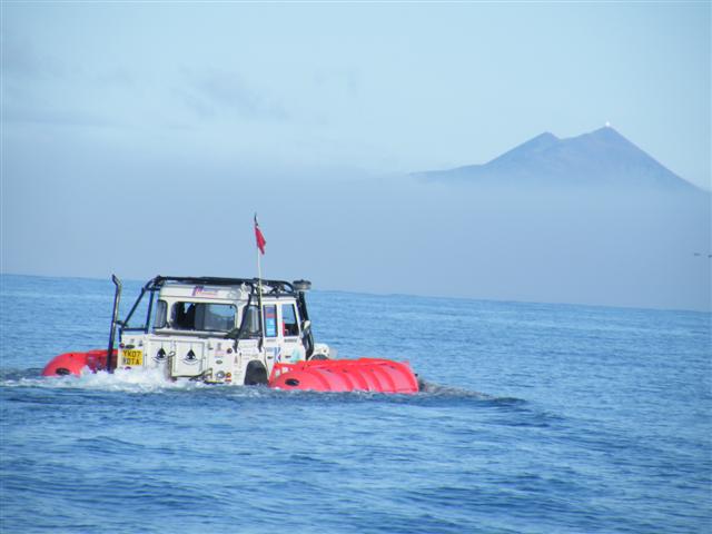
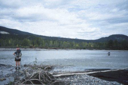
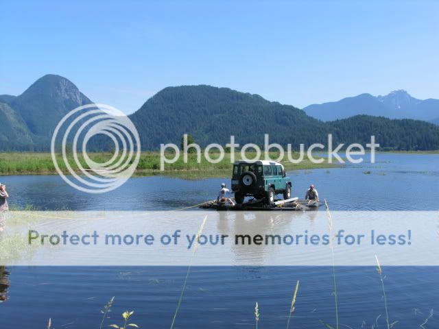